PowerPoint Maps
Our wide selection of professionally designed PowerPoint map templates, each more unique and inspiring than the last, allows you to quickly and easily build visually impressive presentations. With several map designs, customization options, and pre-built features such as markers, labels, and routes, you can easily display geographic data, places, and travel routes. Whether you're an instructor, a business professional, or a student, our templates offer a diverse option for entertaining and informative presentations.
 (457)
(457) Afghanistan PowerPoint Maps: Craft Compelling Geographic StoriesID: #PM00239$35.00
 (946)
(946) Indonesia PowerPoint Maps: Visualize the Archipelago with EaseID: #PM00238$32.00
 (1024)
Customizable Malaysia PowerPoint Maps for Dynamic PresentationsID: #PM00237$30.00
(1024)
Customizable Malaysia PowerPoint Maps for Dynamic PresentationsID: #PM00237$30.00 (190)
Pakistan Map PowerPoint Template: Fully Editable 37-Slide DeckID: #PM00236$30.00
(190)
Pakistan Map PowerPoint Template: Fully Editable 37-Slide DeckID: #PM00236$30.00 (375)
(375) Philippines Map PowerPoint Template - 37 Fully Editable Slides, Instant DownloadID: #PM00235$34.00
 (161)
South Korea PowerPoint Maps TemplateID: #PM00234$40.00
(161)
South Korea PowerPoint Maps TemplateID: #PM00234$40.00 (542)
Thailand PowerPoint Maps: Navigate Narratives with Stunning, Customizable SlidesID: #PM00233$45.00
(542)
Thailand PowerPoint Maps: Navigate Narratives with Stunning, Customizable SlidesID: #PM00233$45.00 (849)
Vietnam Map PowerPoint Template - Fully Editable, Instant DownloadID: #PM00232$38.00
(849)
Vietnam Map PowerPoint Template - Fully Editable, Instant DownloadID: #PM00232$38.00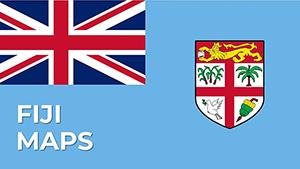 (434)
Fiji PowerPoint Maps Template: Dive into Island Paradise VisualsID: #PM00231$30.00
(434)
Fiji PowerPoint Maps Template: Dive into Island Paradise VisualsID: #PM00231$30.00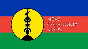 (840)
(840) New Caledonia PowerPoint Maps Template: Precision Mapping for Impactful PresentationsID: #PM00230$18.00
 (54)
Papua New Guinea PowerPoint Maps Template: Unlock Cultural and Geographic WondersID: #PM00229$38.00
(54)
Papua New Guinea PowerPoint Maps Template: Unlock Cultural and Geographic WondersID: #PM00229$38.00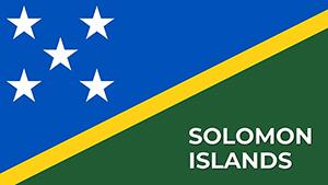 (1010)
Solomon Islands PowerPoint Map Template: Customizable Slides for Dynamic PresentationsID: #PM00228$17.00
(1010)
Solomon Islands PowerPoint Map Template: Customizable Slides for Dynamic PresentationsID: #PM00228$17.00 (864)
Vanuatu PowerPoint Maps Template: Island Adventures VisualizedID: #PM00227$27.00
(864)
Vanuatu PowerPoint Maps Template: Island Adventures VisualizedID: #PM00227$27.00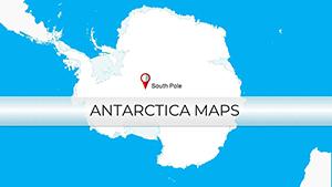 (703)
Antarctica PowerPoint Maps Template: Unveil Polar SecretsID: #PM00226$15.00
(703)
Antarctica PowerPoint Maps Template: Unveil Polar SecretsID: #PM00226$15.00 (83)
Falkland Islands PowerPoint Maps TemplateID: #PM00225$15.00
(83)
Falkland Islands PowerPoint Maps TemplateID: #PM00225$15.00 (703)
Editable Algeria Map PowerPoint Template: Professional Slides for Impactful PresentationsID: #PM00224$38.00
(703)
Editable Algeria Map PowerPoint Template: Professional Slides for Impactful PresentationsID: #PM00224$38.00 (344)
Botswana PowerPoint Maps Template: Delta into Diamond DynamicsID: #PM00223$38.00
(344)
Botswana PowerPoint Maps Template: Delta into Diamond DynamicsID: #PM00223$38.00 (738)
Egypt PowerPoint Maps Template: Chart the Nile's Eternal FlowID: #PM00222$42.00
(738)
Egypt PowerPoint Maps Template: Chart the Nile's Eternal FlowID: #PM00222$42.00 (715)
Kenya PowerPoint Maps: Ignite Your East African NarrativesID: #PM00221$37.00
(715)
Kenya PowerPoint Maps: Ignite Your East African NarrativesID: #PM00221$37.00 (145)
Libya Maps PowerPoint Template: Echoes of EmpiresID: #PM00220$40.00
(145)
Libya Maps PowerPoint Template: Echoes of EmpiresID: #PM00220$40.00 (402)
Morocco PowerPoint Maps: Weave Tales from the AtlasID: #PM00219$38.00
(402)
Morocco PowerPoint Maps: Weave Tales from the AtlasID: #PM00219$38.00 (1022)
Zimbabwe Maps PPT Template: Chart the Land of LegendsID: #PM00218$38.00
(1022)
Zimbabwe Maps PPT Template: Chart the Land of LegendsID: #PM00218$38.00 (768)
Tanzania Maps PowerPoint Template: Visualize the Safari SpiritID: #PM00217$38.00
(768)
Tanzania Maps PowerPoint Template: Visualize the Safari SpiritID: #PM00217$38.00 (939)
Somalia PowerPoint Maps Presentation Template: Download PPTID: #PM00216$35.00
(939)
Somalia PowerPoint Maps Presentation Template: Download PPTID: #PM00216$35.00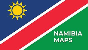 (508)
Namibia PowerPoint Maps Template: Sculpting Stories from SandID: #PM00215$56.00
(508)
Namibia PowerPoint Maps Template: Sculpting Stories from SandID: #PM00215$56.00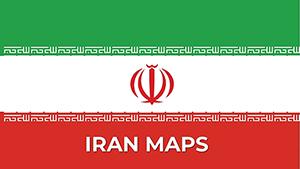 (133)
Iran PowerPoint Maps Template: Charting Paths to PersuasionID: #PM00214$50.00
(133)
Iran PowerPoint Maps Template: Charting Paths to PersuasionID: #PM00214$50.00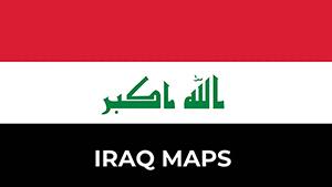 (452)
Iraq PowerPoint Maps Template: Unlock Geographical NarrativesID: #PM00213$54.00
(452)
Iraq PowerPoint Maps Template: Unlock Geographical NarrativesID: #PM00213$54.00 (708)
Israel PowerPoint Maps: Download PPTID: #PM00212$55.00
(708)
Israel PowerPoint Maps: Download PPTID: #PM00212$55.00 (229)
Jordan PowerPoint Maps: Custom Pro TemplateID: #PM00211$45.00
(229)
Jordan PowerPoint Maps: Custom Pro TemplateID: #PM00211$45.00 (945)
Dynamic Kuwait Maps PPT: Business-ReadyID: #PM00210$50.00
(945)
Dynamic Kuwait Maps PPT: Business-ReadyID: #PM00210$50.00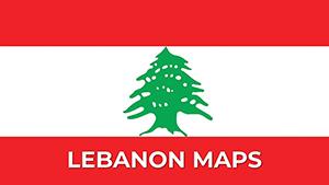 (697)
Lebanon Map PowerPoint Template - Fully Editable Vector Maps | Instant DownloadID: #PM00209$40.00
(697)
Lebanon Map PowerPoint Template - Fully Editable Vector Maps | Instant DownloadID: #PM00209$40.00 (447)
Fully Editable Oman Maps PowerPoint Template | Instant DownloadID: #PM00208$38.00
(447)
Fully Editable Oman Maps PowerPoint Template | Instant DownloadID: #PM00208$38.00 (511)
Qatar's Blueprint: PowerPoint Maps Template for Bold VisionsID: #PM00207$54.00
(511)
Qatar's Blueprint: PowerPoint Maps Template for Bold VisionsID: #PM00207$54.00
PowerPoint Maps Templates are pre-designed slide templates incorporating maps of various geographic places. These templates can be used in PowerPoint presentations to graphically display data, demonstrate geographic features, or improve the overall visual attractiveness of the presentation. They are especially beneficial for corporate, educational, and personal tasks that need the clear and effective presentation of geographical data.
What are the PowerPoint Maps Templates?
PowerPoint Maps Templates are pre-made slides with maps of various locations, nations, states, and continents. These templates allow users to alter the maps by adding labels, markers, or data points. They offer a simple and economical method to incorporate high-quality maps into presentations without requiring substantial graphic design abilities.
Benefits of Using PowerPoint Map Templates:
Using PowerPoint Maps Templates has various benefits:
- Maps offer a clear visual representation of geographical data, facilitating audience comprehension and interpretation.
- Pre-designed templates save users time by eliminating the need to generate maps from scratch. They may easily insert and adjust the template based on their needs.
- High-quality map templates provide gloss and refinement to a presentation, making it more professional.
- These templates are versatile and may be used for various reasons, including commercial presentations, educational lectures, and personal projects.
- Ease of Use: Most themes are user-friendly, so even individuals with modest technical knowledge may generate visually stunning presentations.
Types of PowerPoint Map Templates
PowerPoint Maps Templates are available in various formats, each having a distinct function.
- Planet Maps: These templates offer maps of the entire planet, which are ideal for worldwide data display or international business presentations.
- Regional Maps: These focus on certain regions, such as Asia, Europe, or Africa, and are perfect for region-specific data.
- Country Maps: Detailed maps of particular nations, suitable for national-level presentations.
- State/Province Maps: Templates that incorporate maps of states or provinces within a country, ideal for more specialized data.
- City Maps: Detailed maps of cities that may be used for urban planning presentations, local business reports, or tourist guides.
Examples of Using PowerPoint Map Templates in Different Situations:
PowerPoint Maps Templates may be used in various settings.
- Business Presentations: Companies can use these templates to display market statistics, regional sales reports, or worldwide growth strategies.
- Teachers and lecturers: Can use maps to illustrate geographic ideas, historical events, or demographic research.
- Travel & Tourism: Travel businesses might utilize city or national maps to emphasize tourist spots, travel routes, or tour packages.
- Public health workers: Can use maps to indicate disease transmission, vaccination coverage, and healthcare facility locations.
- Research Reports: Researchers might offer geographical data relating to their research, such as migration trends, environmental studies, or economic dispersion.
Where and Who Needs PowerPoint Map Templates?
PowerPoint Maps Templates are required by many professionals and organizations, including:
- Business: For sales presentations, market analysis, and strategic planning.
- Educational institutions: Teach geography, history, and social studies.
- Non-profit organizations: Use data visualization in reports, fundraising presentations, and awareness initiatives.
- Government agencies: For public health announcements, infrastructure planning, and policy discussions.
- Travel agencies: Create visually engaging trip guides and advertising materials.
User Reviews for PowerPoint Maps Templates
Users of PowerPoint Maps Templates frequently laud their usefulness and ease of use. Below are some user reviews:
- John S., Marketing Manager: "PowerPoint Maps Templates have significantly improved our sales presentations. The flexibility to adapt maps to reflect our data has significantly improved the engagement and professionalism of our presentations."
- Emily R., High School Teacher: "Using map templates in my geography classrooms has made teaching much more engaging. Students can readily envision the issues we discuss, which keeps them more interested."
- Michael L., Non-Profit Director: "We commonly utilize map templates to demonstrate the impact of our programs in various locations. They help our stakeholders comprehend our work and its scope."
- Sarah T., Travel Agent: "These city map templates are ideal for our trip presentations. They allow us to emphasize major destinations and routes, making it easier for clients to organize their journeys."
PowerPoint Maps Templates are an excellent resource for anybody who needs to display geographic data simply and professionally. Whether you're a business professional, an educator, or a researcher, these templates may help you produce powerful and visually appealing presentations.
Questions and Answers regarding PowerPoint Map Templates
- What are PowerPoint Maps Templates? PowerPoint Maps Templates are pre-designed presentations including various sorts of maps. These templates allow presenters to successfully graphically display geographic data, regional statistics, or spatial information in their presentations.
- Why should I use PowerPoint Maps Templates? Using PowerPoint Maps Templates helps you to visually improve your presentation, making difficult geographic data more understandable. They contribute to clearly and professionally presenting trends, comparisons, and distributions.
- What maps may be included in PowerPoint Maps Templates? PowerPoint Maps Templates can contain several maps, including global maps, nation maps, continent maps, state maps, and regional maps. These may be tailored to showcase particular places, regions, or data points.
- How can PowerPoint Maps Templates help my presentation? These templates save time and effort when building maps from scratch. They provide your presentation with a professional appearance, increase data visualization, and assist you in communicating with your audience straightforwardly and effectively.
- Can I edit the maps in PowerPoint Maps Templates? Yes, PowerPoint Maps Templates are very adaptable. You may change the colors, add labels, highlight certain sections, and enter data to fit your presentation's demands.
- How can I add a PowerPoint Maps Template to my presentation? To insert a PowerPoint Maps Template, download the template from your preferred source, open your PowerPoint presentation, navigate to the desired slide, and copy-paste or import the map slide from the downloaded template file.
- Are PowerPoint Maps Templates suitable for corporate presentations? Absolutely. PowerPoint Maps Templates are perfect for business presentations, including market analysis, sales regions, regional performance, or demographic data.
- How do PowerPoint Map Templates aid in educational presentations? PowerPoint Maps Templates are used in educational presentations to teach geography, history, social studies, and other disciplines. They use visual aids to help describe geographical places, historical events, and cultural areas.
- Can I use PowerPoint Maps Templates to create interactive presentations? You can improve interaction by incorporating hyperlinks, triggers, and animations into PowerPoint Maps templates. This can help your presentation become more interesting and informative.
- Are the PowerPoint Maps Templates compatible with other presentation software? Many map templates are built for PowerPoint. However, they may be exported or converted for usage in other presentation applications, such as Google Slides and Keynote, with minor tweaks required for compatibility.