Asia PowerPoint Maps
Enhance your presentations with our diverse collection of Asia map templates for PowerPoint. These professionally designed, fully editable maps cover the entire continent and key countries, helping you deliver clear, impactful messages on geography, markets, or cultural topics.
Completely customizable, you can modify colors to highlight specific areas, add custom labels, insert data points, and adjust layouts to match your branding. Choose from free templates for essential needs or premium versions featuring advanced animations, detailed sub-regions, and modern aesthetics.
Compatible with both PowerPoint and Keynote, these vector-based maps scale perfectly without quality loss. Ideal for executives analyzing Asian markets, teachers exploring regional diversity, or marketers crafting targeted campaigns.
Start creating more engaging slides - explore the collection and download your preferred Asia map template today.
 (457)
(457) Afghanistan PowerPoint Maps: Craft Compelling Geographic StoriesID: #PM00239$35.00
 (946)
(946) Indonesia PowerPoint Maps: Visualize the Archipelago with EaseID: #PM00238$32.00
 (1024)
Customizable Malaysia PowerPoint Maps for Dynamic PresentationsID: #PM00237$30.00
(1024)
Customizable Malaysia PowerPoint Maps for Dynamic PresentationsID: #PM00237$30.00 (190)
Pakistan Map PowerPoint Template: Fully Editable 37-Slide DeckID: #PM00236$30.00
(190)
Pakistan Map PowerPoint Template: Fully Editable 37-Slide DeckID: #PM00236$30.00 (375)
(375) Philippines Map PowerPoint Template - 37 Fully Editable Slides, Instant DownloadID: #PM00235$34.00
 (161)
South Korea PowerPoint Maps TemplateID: #PM00234$40.00
(161)
South Korea PowerPoint Maps TemplateID: #PM00234$40.00 (542)
Thailand PowerPoint Maps: Navigate Narratives with Stunning, Customizable SlidesID: #PM00233$45.00
(542)
Thailand PowerPoint Maps: Navigate Narratives with Stunning, Customizable SlidesID: #PM00233$45.00 (849)
Vietnam Map PowerPoint Template - Fully Editable, Instant DownloadID: #PM00232$38.00
(849)
Vietnam Map PowerPoint Template - Fully Editable, Instant DownloadID: #PM00232$38.00 (702)
(702) Russia PowerPoint Maps Template: Precision for Every PresentationID: #PM00203$55.00
 (1181)
Asia Countries PowerPoint Maps: Quick PPT DownloadID: #PM00159$16.00
(1181)
Asia Countries PowerPoint Maps: Quick PPT DownloadID: #PM00159$16.00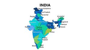 (18)
Complete India PowerPoint Maps Presentation: Weave Stories of DiversityID: #PM00081$25.00
(18)
Complete India PowerPoint Maps Presentation: Weave Stories of DiversityID: #PM00081$25.00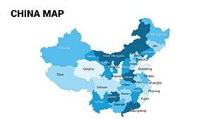 (778)
Complete China Editable PowerPoint Maps TemplateID: #PM00073$25.00
(778)
Complete China Editable PowerPoint Maps TemplateID: #PM00073$25.00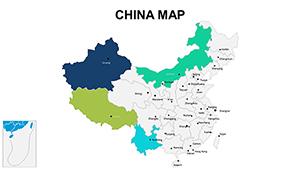 (130)
Administrative China PowerPoint Maps Template: Elevate Your Regional InsightsID: #PM00069$18.00
(130)
Administrative China PowerPoint Maps Template: Elevate Your Regional InsightsID: #PM00069$18.00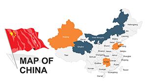 (512)
Editable China PowerPoint Maps: Charting Pathways to ProgressID: #PM00057$48.00
(512)
Editable China PowerPoint Maps: Charting Pathways to ProgressID: #PM00057$48.00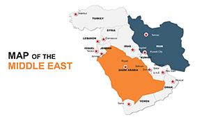 (848)
Custom Middle East Maps PPT: Navigate Global NarrativesID: #PM00049$48.00
(848)
Custom Middle East Maps PPT: Navigate Global NarrativesID: #PM00049$48.00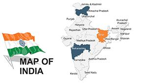 (44)
Customizable India PowerPoint Maps: Vast Narratives UnveiledID: #PM00048$48.00
(44)
Customizable India PowerPoint Maps: Vast Narratives UnveiledID: #PM00048$48.00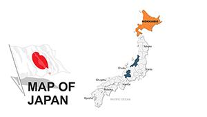 (796)
Editable Japan PowerPoint Maps Template: Infuse Eastern PrecisionID: #PM00047$54.00
(796)
Editable Japan PowerPoint Maps Template: Infuse Eastern PrecisionID: #PM00047$54.00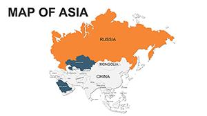 (116)
Asia PowerPoint Maps Template - Versatile VisualsID: #PM00039$48.00
(116)
Asia PowerPoint Maps Template - Versatile VisualsID: #PM00039$48.00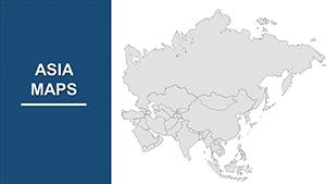 (1123)
Asia Map PowerPoint Template - Fully Editable & Professional MapsID: #PM00026$50.00
(1123)
Asia Map PowerPoint Template - Fully Editable & Professional MapsID: #PM00026$50.00 (420)
Japan PowerPoint Maps: Detail-Oriented for Cultural and Business DepthID: #PM00016$40.00
(420)
Japan PowerPoint Maps: Detail-Oriented for Cultural and Business DepthID: #PM00016$40.00 (403)
India PowerPoint Maps Template: Visualize Diversity with EaseID: #PM00015$46.00
(403)
India PowerPoint Maps Template: Visualize Diversity with EaseID: #PM00015$46.00 (1031)
China PowerPoint Maps Template: Customizable PPTID: #PM00004$40.00
(1031)
China PowerPoint Maps Template: Customizable PPTID: #PM00004$40.00
Why Invest in Professional Asia Map Templates for Presentations?
Standard PowerPoint shapes and online images often fall short when you need accurate, detailed maps of Asia. Our dedicated templates provide precise boundaries, labeled regions, and layered elements that make customization straightforward and results polished.
Whether presenting the full continent or focusing on high-growth areas like East Asia or South Asia, these maps help your audience quickly grasp spatial relationships and data patterns.
Real-World Use Cases for Asia PowerPoint Maps
Business Expansion and Market Analysis
Illustrate market penetration strategies, sales distribution, or supply chain networks across Asian countries. Color-code regions by revenue, growth potential, or risk factors to make complex data immediately understandable.
Educational and Training Sessions
Educators and trainers use these maps to teach geography, history, economics, or cultural studies. Highlight capitals, trade routes, or demographic shifts while engaging students with clean, modern visuals.
Marketing and Campaign Planning
Showcase regional targeting for advertising campaigns or customer segmentation. Demonstrate reach across Southeast Asia, the Middle East, or Central Asian markets with professional-grade visuals.
Travel, Tourism, and Non-Profit Reports
Design compelling itineraries, destination overviews, or impact reports showing project locations across Asia.
Advantages Over Default or Generic Maps
- Precision and Detail: Accurate country outlines and sub-regions not available in basic tools.
- Vector Quality: Infinite scalability without pixelation.
- Layered Elements: Edit individual countries or features separately.
- Pre-Built Styles: Modern color schemes and design options ready for 2026 trends.
- Time-Saving: Start with professional layouts instead of building from scratch.
Creative Tips and Best Practices
Maximize impact with these proven techniques:
- Use meaningful color coding - assign distinct shades to different metrics or categories.
- Apply subtle animations to reveal regions sequentially during your talk.
- Pair maps with supporting charts or infographics on the same slide.
- Avoid overcrowding - focus on 3-7 key areas per slide.
- Ensure text contrast against background colors for readability.
Following these practices turns simple maps into powerful storytelling tools.
Ready to create presentations that stand out? Browse our Asia map templates and download the perfect one for your next project.
Frequently Asked Questions About Asia PowerPoint Map Templates
Are the Asia map templates fully editable in PowerPoint?
Yes, every template is 100% editable. You can modify colors, text, shapes, labels, and layers to perfectly match your content and branding requirements.
What's the difference between free and premium Asia map templates?
Free templates provide clean, editable core maps with essential features. Premium templates include extra design variations, animations, more detailed sub-regions, and advanced customization options for elevated professionalism.
Can I use these templates for commercial and client presentations?
Yes, both free and premium templates are licensed for personal and commercial use, including client work, reports, and public presentations.
Are the country boundaries accurate and up to date?
We use reliable sources for boundary data to ensure high accuracy. However, geopolitical situations can change, so for sensitive topics, cross-reference with official sources.
How do I add my own data or labels to these maps?
Select any element and edit directly in PowerPoint. Add text boxes, icons, or connect to Excel data for dynamic updates where supported. Layers make individual adjustments simple.