Asia PowerPoint Maps

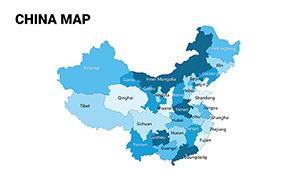
Navigate the intricacies of Asia through our PowerPoint map templates, ideal for anyone presenting on this pivotal continent. Geographers, executives, and students alike will appreciate the accuracy and adaptability these tools offer.

Designed specifically for Microsoft PowerPoint, they feature drag-and-drop elements for quick modifications - shade regions by GDP, label capitals, or animate expansions. Benefits include enhanced clarity in complex topics, time savings on design, and audience retention through visual storytelling.

From corporate strategy sessions mapping market shares to academic overviews of cultural heritages, these templates empower confident delivery. Their responsive formats ensure flawless viewing on projectors or laptops.

Browse the collection and plot your path to persuasive presentations.


View by: Last Added | Most Popular
  • like 2
    (457)
    Afghanistan PowerPoint Maps: Craft Compelling Geographic Stories
    ID: #PM00239
    $35.00
  • like 4
    (946)
    Indonesia PowerPoint Maps: Visualize the Archipelago with Ease
    ID: #PM00238
    $32.00
  • like 4
    (1024)
    Customizable Malaysia PowerPoint Maps for Dynamic Presentations
    ID: #PM00237
    $30.00
  • like 4
    (190)
    Pakistan PowerPoint Map Template: Versatile Slides for Geographic and Professional Insights
    ID: #PM00236
    $30.00
  • like 3
    (375)
    Philippines PowerPoint Maps: Island-Hop Through Insights with Ease
    ID: #PM00235
    $34.00
  • like 3
    (161)
    South Korea PowerPoint Maps: Precision Mapping for Persuasive Power
    ID: #PM00234
    $48.00
  • like 4
    (849)
    Vietnam PowerPoint Maps Template: Comprehensive Asia Mapping for Dynamic Insights
    ID: #PM00232
    $40.00
  • like 2
    (67)
    Syria Map PowerPoint Template: Geopolitical Insights
    ID: #PM00205
    $50.00
  • like 5
    (543)
    Sand to Strategy: UAE PowerPoint Maps Template Mastery
    ID: #PM00204
    $50.00
  • like 5
    (702)
    Russia PowerPoint Maps Template: Precision for Every Presentation
    ID: #PM00203
    $55.00
  • like 4
    (415)
    Jamaica Keynote Maps: Download Maps of Jamaica Template
    ID: #PM00202
    $50.00
  • like 2
    (1038)
    Global Market Maps PowerPoint Template: Chart Your Worldwide Vision
    ID: #PM00170
    $25.00
  • like 4
    (788)
    World Country Maps PowerPoint Template - Enhance
    ID: #PM00168
    $26.00
  • like 3
    (773)
    World Infographic PowerPoint Maps: Captivate with Global Data Mastery
    ID: #PM00164
    $20.00
  • like 4
    (150)
    World Infographic PowerPoint Maps: Transform Data into Global Narratives
    ID: #PM00163
    $20.00
  • like 2
    (792)
    World Countries PowerPoint Maps: Download PPT
    ID: #PM00162
    $20.00
  • like 3
    (469)
    Business Maps of the World for PowerPoint - Editable PPT Templates
    ID: #PM00161
    $20.00
  • like 5
    (1181)
    Asia Countries PowerPoint Maps: Quick PPT Download
    ID: #PM00159
    $16.00
  • like 5
    (109)
    Continents World Map PPT Template: Download Now
    ID: #PM00088
    $14.00
  • like 5
    (778)
    Complete China Editable PowerPoint Maps Template
    ID: #PM00073
    $25.00
  • like 3
    (130)
    Administrative China PowerPoint Maps Template: Elevate Your Regional Insights
    ID: #PM00069
    $18.00
  • like 5
    (848)
    Custom Middle East Maps PPT: Navigate Global Narratives
    ID: #PM00049
    $48.00
  • like 3
    (44)
    Customizable India PowerPoint Maps: Vast Narratives Unveiled
    ID: #PM00048
    $48.00


Versatile Applications of Asia Maps in PowerPoint

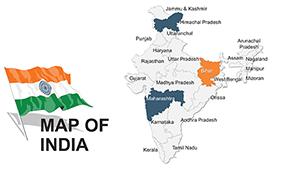
PowerPoint`s robustness shines in geographic visuals, and our Asia maps amplify that. Use cases span from e-commerce dashboards tracking consumer trends across borders to environmental reports on deforestation patterns. Educators craft lessons on ancient empires, using layered timelines overlaid on terrains.

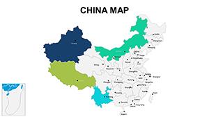
Versus default shapes, these templates deliver pre-aligned coordinates and thematic icons, reducing errors and boosting polish. Industries like tourism highlight scenic routes with photo integrations, while finance firms chart investment flows via arrow annotations.

Standout Template Capabilities

  • Political Boundaries: Fully outlined with hover effects for details.
  • Topographic Layers: Elevation shading for depth perception.
  • Chart Embeddings: Pie graphs per country for balanced views.
  • Theme Switches: Day/night modes for varied lighting.

The edge? Inclusive design with multilingual labels and color-blind friendly palettes. Pro tips: segment large maps into sub-regions for focus, synchronize animations with narration, and use hyperlinks for supplemental facts.

Innovative Ways to Leverage These Maps

Envision a startup pitching to VCs: a map pulses with growth projections, countries lighting up sequentially. Or a policy analyst debating trade agreements, with tariff barriers visualized as barriers on paths. Such creativity turns data dumps into dialogues.

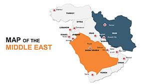
Customize strategically - for Middle East focus, emphasize oil routes; for East Asia, tech hubs. Limit text to essentials, letting visuals lead.

Optimization Steps for Peak Performance

  1. Validate data sources before embedding.
  2. Apply subtle shadows for 3D illusion.
  3. Rehearse zoom-ins for emphasis.
  4. Save as templates for reuse.

Chart new territories in your presentations. Secure a template and illuminate Asia`s story.

Frequently Asked Questions

Clarifying your cartographic queries.

Your mapping adventure begins here - download and discover.