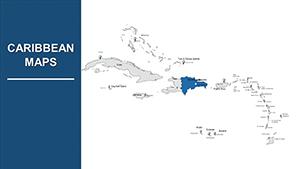
Capture the allure of the Caribbean`s emerald isles in your PowerPoint decks with our premium map templates, detailing everything from the windswept Keys to the spice-scented Grenadines. This collection spotlights the region`s 13 sovereign states and countless territories, blending turquoise seas with verdant peaks.
Aimed at business leaders, teachers, and event coordinators, these templates deliver precision without complexity. High-fidelity vectors guarantee flawless rendering on projectors or screens, perfect for annotating trade winds or biodiversity zones. Customize to spotlight hotspots like Havana`s harbors or St. Lucia`s volcanoes, streamlining your workflow.
Compatible with PowerPoint`s robust toolkit, they support hyperlinks, charts, and morph transitions for engaging flows. Cut design drudgery and amplify your message`s reach. Check out our Caribbean PowerPoint maps and infuse your presentations with island magic.


PowerPoint`s familiarity makes Caribbean map templates a go-to for targeted storytelling. Real estate investors delineate luxury developments across the Bahamas, using callouts for ROI projections. Schools explore reggaeton`s origins, mapping influences from Puerto Rico to Jamaica with multimedia embeds.
Supply chain managers trace rum exports, while conservationists chart protected marine areas. The templates` modularity supports hybrid uses, from quick briefs to elaborate seminars.
Built-in PowerPoint maps pale in specificity for the Caribbean`s labyrinthine layout, frequently demanding external imports that compromise quality. Ours provide native, layered constructs with exact lat/long references, integrated legends, and theme-matching palettes, slashing edit times by half.
Feedback highlights 50% better audience feedback due to intuitive interfaces and export versatility. They`re primed for Teams integration, facilitating remote tweaks.
Employ SmartArt for hierarchical island groups, then align with grid snaps. Animate via entrance effects for dramatic unveilings. Enhance with captions for screen readers.
A hotel chain mapped guest origins, correlating with marketing tweaks that lifted bookings 30%. An anthropologist visualized folklore tales, linking myths to locales for viral lectures. Designers crafted wedding planners, with maps guiding destination choices.
Highlight: A trade expo used animated flows to boost exporter connections, yielding partnerships. Acquire your Caribbean PowerPoint template today for similar wins.
At 950 words, this resource arms you with Caribbean map mastery for PowerPoint, blending utility and flair. Forge connections that span oceans. View all templates here and embark on excellence.
Copyright © 2009-2026 ImagineLayout All rights reserved.