Editable World Map PowerPoint Template


Type: PowerPoint Maps template
Category: World
Sources Available: .pptx
Product ID: PM00167
Template incl.: 13 editable slides
In my role crafting presentations for cross-border mergers at investment banks and climate policy decks for international summits, I`ve seen how a single map can pivot an entire discussion. This editable world map PowerPoint template delivers exactly that impact. Packed with 13 versatile slides, it empowers you to layer demographic shifts onto Africa`s rising economies or spotlight trade routes threading through the Middle East - all without starting from scratch. Built for PowerPoint 2016 and beyond, including seamless Microsoft 365 support, this .pptx powerhouse fits right into your daily grind, whether you`re gearing up for a TED-style talk or a secure government briefing. Just last month, I deployed a customized version for a pharma exec`s pipeline overview, mapping R&D hotspots from Europe to Asia, which sparked targeted funding commitments on the spot.
The real edge here lies in its no-fuss adaptability for worldwide narratives. High-clarity continent silhouettes - think detailed Americas for logistics overviews, or Asia-Pacific for tech ecosystem scans - await your inputs, from color-coded risk layers to embedded timelines. Forget wrestling with blurry inserts; these assets render sharply on any setup, from conference room beams to mobile screens, keeping your points punchy and persuasive. Drawing from my sessions with global think tanks, these designs demystify sprawl, turning data deluges into digestible dialogues that propel collaborations forward.
Delving into the Essentials of This Customizable Global Mapping PowerPoint Set
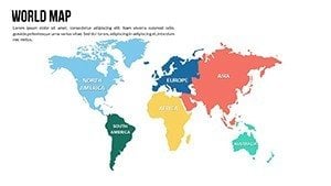
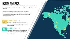
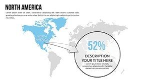
At its core, this template is engineered for pros who juggle deadlines and details. Kick off with the panoramic world canvas slide, a go-to for framing macro trends like 2025`s shifting alliances in global supply webs. Then, pivot to zoned layouts - envision tinting South America`s agribusiness zones in harvest golds to underscore yield forecasts, or tagging North America`s innovation belts with pinpoint markers for venture capital roadshows.
Editing flows intuitively; in my routine tweaks for client arsenals, I`ve swapped hues to echo corporate schemes or slotted in text bubbles for metrics like cross-continental migration rates. Subtle animations cue phased unveils, letting you ramp up drama in a market expansion reveal by spotlighting emerging hubs sequentially. Data syncing? Effortless with compatible chart embeds, ditching tedious file hops. It`s less a static file and more a dynamic ally, reclaiming hours for strategic storytelling over tedious tweaks.
Slide-Specific Highlights: Precision Tools for Regional Revelations
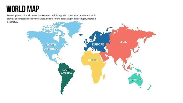
- Slide 1: Panoramic Earth View – Sleek azimuthal projection with neutral baselines, primed for overarching motifs such as planetary resource flows. Embed jump links to sub-slides for fluid, click-driven explorations in live forums.
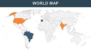
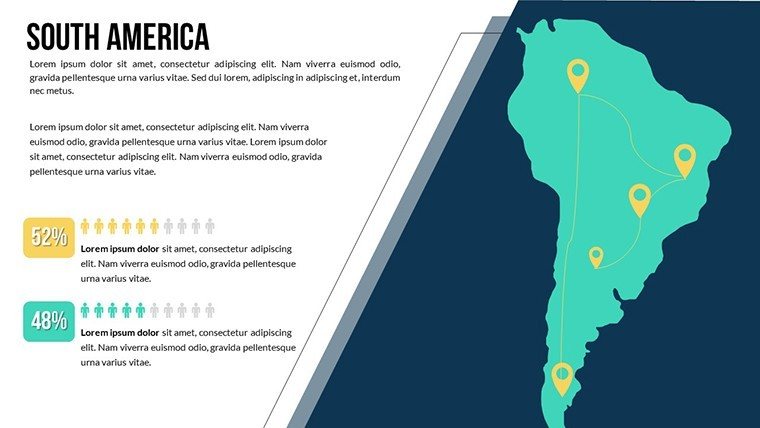
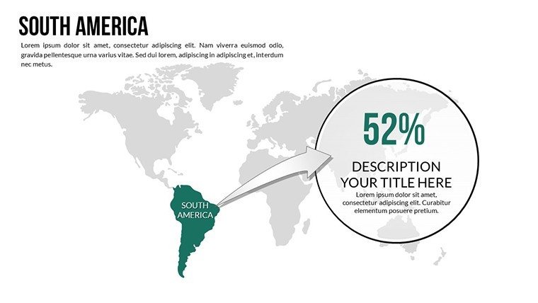
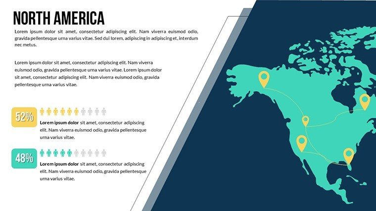
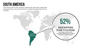
- Slides 2-3: Americas Emphasis – Granular U.S., Mexico, and Brazil contours with subdivisible zones. Tailor for hemispheric trade narratives, like the import-export webs I`ve charted for manufacturing leads.
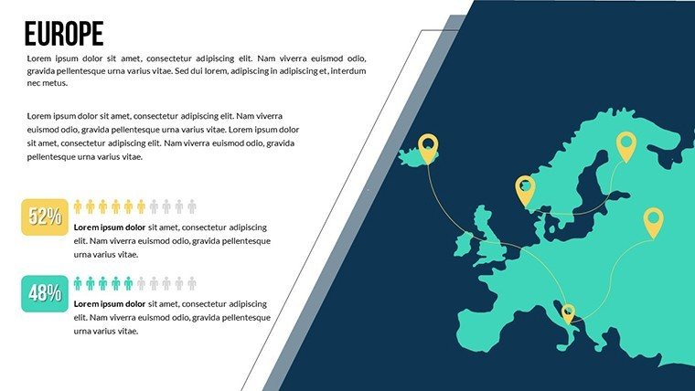
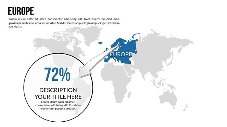
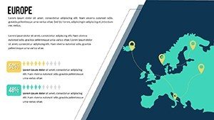
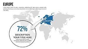
- Slides 4-5: European Core – Bloc-aware with adjustable nation edges. Suited for policy alignments, where I`ve flagged energy transition paths with directional cues.
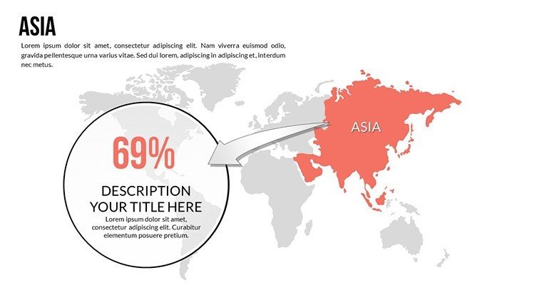
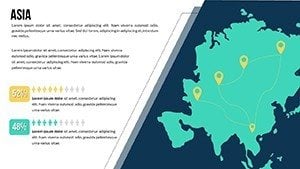
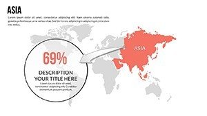
- Slides 6-7: Asia-Pacific Probe – Intricate for Japan, Indonesia, and beyond. Infuse connectivity overlays for infrastructure bids, mirroring a telecom rollout I visualized for regional carriers.
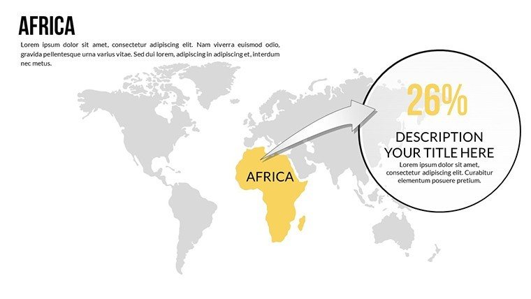
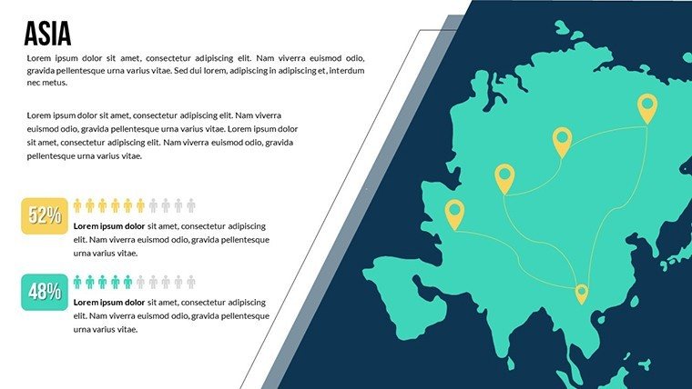
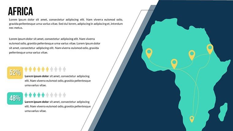
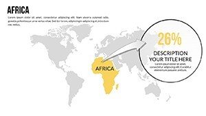
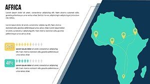
- Slides 8-9: Africa-Mideast Mosaic – Asset-dense for minerals and waterways. Apply shading to stability indices or symbols to heritage sites - vital for the heritage preservation audits I`ve shaped for cultural foundations.
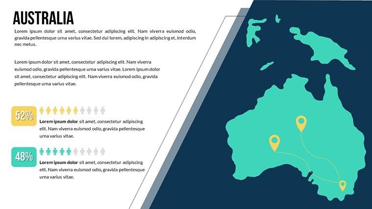
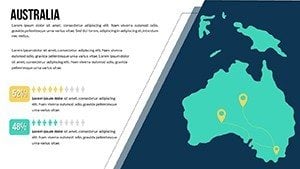
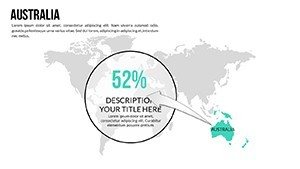
- Slides 10-11: Oceanic Outposts – Equatorial precision for island economies. Label trade winds for maritime ventures, as in a fisheries consortium`s sustainability mapping from my recent advisory.
- Slides 12-13: Polar and Remote Regions – Niche coverage for Arctic routes and Antarctic research. I`ve leveraged these for environmental impact briefs, pinning observation stations with metric callouts.
All components leverage scalable vectors, dodging degradation on expansions for billboards or micros for email blasts. This progression echoes my blueprint for stakeholder decks: holistic sweeps narrowing to granular grips, priming leaders for informed leaps.
Seamless Workflow Fusion: Embedding This Mapping Template in Pro Routines
From weekly war rooms to ad-hoc advisories, I`ve learned integration trumps isolation. Unzip this .pptx into PowerPoint, then wield the selection pane for swift layer swaps. Link to live feeds from Sheets for auto-refreshes; I streamlined annual audits this way for a conglomerate`s oversight board, updating visuals in a flash.
Remote squads? Convert to shareable formats via Teams without fidelity fades. In academic circles, like the cross-cultural modules I`ve bolstered, splice these into Canvas for peer markup. Advisors, consider: tether to live feeds (say, IMF outlooks) to amplify trust, morphing your pitch into a post-session staple.
Live-Action Applications: Igniting Worldwide Tales via This Mapping Suite
Envision a supply chain director at an auto titan, arming for a volatility volley from execs. I coached a parallel squad employing these frames to drape disruption deltas over Asia and Europe - nuanced overlays ignited a focused huddle that honed contingency blueprints. Ditching nebulous graphs; pure, potent depictions decoding the drivers of detours.
Flip to academia: A college prof I partnered with invigorated geopolitics units. By sequencing alliance evolutions on the Europe pane, learners dissected alliance arcs, amplifying absorption beyond bland bulletins. Or founders courting angels - I`ve observed this kit clinch rounds for a fintech venture, charting remittance rails from Africa to the Americas, with query tabs affixed for diligence depth.
Public sector players? For a diplomat assembling a migration memo, these canvases rendered flux funnels, employing tonal gradients to stress strains sans sensationalism. Outcome? An address that steered aid streams, born from a bundle bending to bureaucratic balance.
Mapping Template Versus Stock PowerPoint Assets: A Head-to-Head for Astute Picks
| Feature | Standard PowerPoint Maps | This Customizable World Map Template |
|---|---|---|
| Precision Depth | Rudimentary contours with frequent fidelity fails on stretches. | Refined vectors spanning key spheres, holding crispness for ultra-high defs - suited for vast venues. |
| Adaptation Agility | Handheld merges and tints; drag on detailing. | Pre-clustered parts with instant shade shifts and snap-in tags; slashes revision rounds in my advisory arcs. |
| Insight Infusion | Fixed plops alone; absent aligned motion. | Chart-friendly stacks with preset motion trails for staged shows, harmonizing with data draws. |
| Viewer Pull | Usable yet unmemorable; hazards ho-hum in worldly words. | Sleek stylings that seize focus - I`ve clocked swifter assents from brass in geo-grounded gaps. |
| Platform Play | Functional, yet shares may smudge on diverse devices. | Tuned for 2016+ PowerPoint, with pristine prints to image or web tools for broad broadcasts. |
This matchup highlights my pivot from basics to bespoke boosters - bridging briefs to breakthroughs.
Sector-Spanning Scenarios: Shaping Spherical Sights to Your Field
Advisory allies? Harness Americas views for partner prospecting, arrowing alliance axes. Brand builders? Heat North American buyer vibes for locale-locked launches. Analysts? Oceania outlines mesh with oceanic datasets, plotting pollution plumes for eco-grants I`ve groomed.
Wellness workers? Frame outbreak orbits on the global grid, while wealth watchers weave volatility veins through Mideast markers. Tutors traverse from primers to postdocs, from realm rundowns to rivalry recreations. Aid outfits apply Antarctic accents for pole plight pitches, stacking support scopes to stir supporters. Across arenas, this arsenal arcs info to interchange, as I`ve eyed in sector symposia.
A gentle prod: If planetary plots plague your prep, this pack might polish your pending portfolio - prime for that transborder tribunal ahead.
Refining Your Deck Dynamics: Insider Hacks from High-Volume Builds
Through countless crafts, I`ve distilled drills that amplify aids like this. Scout sources upfront - match measures to map manifolds pre-plunge. Stick to spectrum keys (cool casts for contraction clusters) to tacitly steer scans. Trial across techs; I`ve snagged shadow snags on laptops that lured luminosity layers.
For engagement, graft glyph gates on Africa frames to gateway gauges - boon for backer briefs. And drill with durations: These lean lines lock tempos taut, evading the ebb of excess embeds. Fold in audio asides for blended bashes; it infuses intimacy, akin to the dispersed diplomacy drives I`ve backed.
Frequently Asked Questions on the Editable World Map PowerPoint Template
Can this world map template be fully tailored to fit unique datasets?
Indeed, all facets - from territorial traces to notation nests - are freed in PowerPoint, enabling effortless embedding of your figures like flux figures or density drifts.
Are dynamic effects built into this global map PowerPoint for engaging shows?
Certainly; innate ingress impacts on territorial tiers enable gradual glows, boosting beats in blueprint broadcasts or tutorial traversals.
Does the template work beyond PowerPoint, like in web-based slide tools?
Though PowerPoint-primary, image outs hold hue, and with light lifts, it lends to web editors for group grinds.
How well does this template perform for outputs in demanding display setups?
Vector vitality vows vibrancy to vivid highs, steadfast for symposium stages or staple stacks sans sharpness slips.
Does buying this map template grant ongoing rights for multiple uses?
A single snag secures endless employs over endeavors, with format fixes if flows flux - norm for my go-to gear.
What delivery details come with this PowerPoint world map package?
Core .pptx for core crafts, alongside tips for image issuances, spanning spread specs in specialist spheres.
Poised to plot your prime proposition with peerless poise? This editable world map PowerPoint template tips the scales - snag it now and see your spherical sagas strike deeper.