Widescreen Maps of World for PowerPoint: Panoramic Global Visions


Type: PowerPoint Maps template
Category: World
Sources Available: .pptx
Product ID: PM00087
Template incl.: 20 editable slides
Step into a wider world of presentation possibilities with our Widescreen Maps of World for PowerPoint Template. Boasting 20 editable slides optimized for 16:9 displays, this collection spans political divisions, physical terrains, and thematic data layers, ideal for global business leaders, geographers, and environmental consultants. Compatible with PowerPoint and Google Slides, it turns standard slides into expansive canvases that immerse audiences in worldwide narratives.
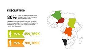
Designed for the modern projector era, these maps avoid distortion, delivering true-to-scale views from the Amazon basin to the Sahara dunes. Draw from NASA elevation data for physical accuracy and customize to fit themes like sustainable development or international trade, ensuring your content feels vast yet focused.
Essential Features for Expansive Presentations
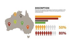
Each slide is a widescreen masterpiece, with scalable vectors that maintain fidelity across devices. Explore types from blank canvases to populated overlays.
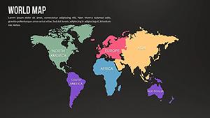
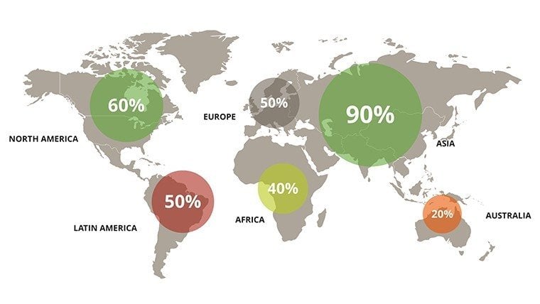
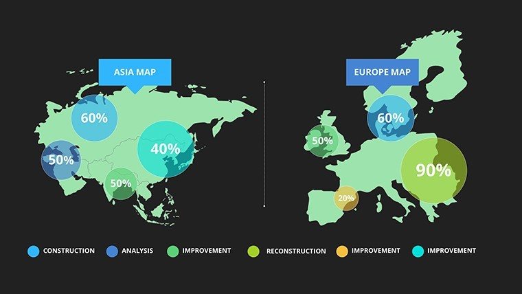
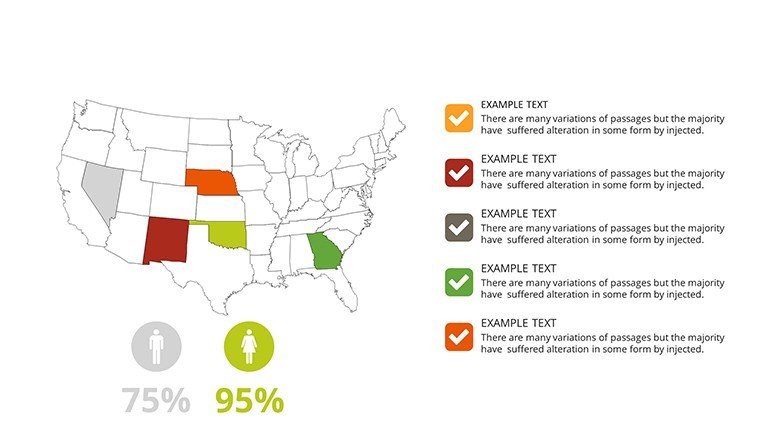
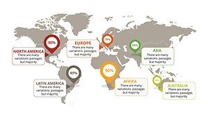
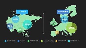
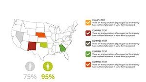
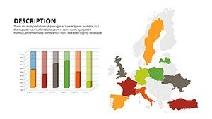
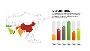
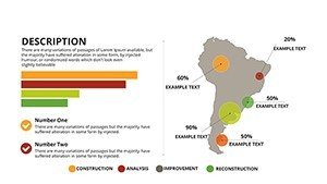
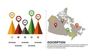
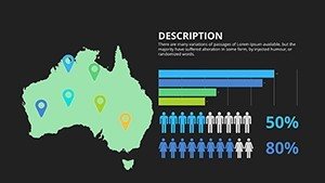
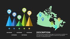
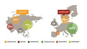
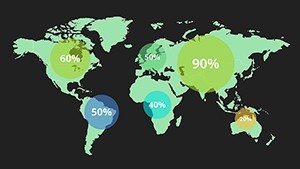
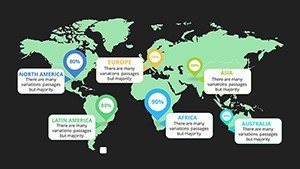
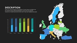
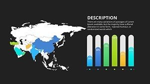
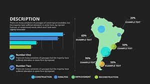
- Diverse Map Varieties: Political (borders/capitals), physical (mountains/oceans), thematic (climate/population), and interactive hybrids.
- Widescreen Optimization: No stretching - perfect proportions for laptops, TVs, and projectors.
- Effortless Customization: Recolor terrains (greens for forests, blues for seas) and add legends dynamically.
- Animation Suites: Pan across continents or fade in features for cinematic effects.
- Integrated Assets: Icons for cities, arrows for migrations, and grids for coordinates.
Outshining narrow templates, this set conforms to ISO standards for cartography, providing a professional edge over DIY designs.
Versatile Use Cases: World in Wide View
Environmental NGOs mapping deforestation? Use the physical world slide to layer satellite-derived loss data, animating yearly changes for urgent impact. A sustainability conference panelist leveraged this to highlight Amazon threats, galvanizing donations.
Business Globalization Tactics
- Import a political world map.
- Highlight trade partners with bold outlines.
- Overlay logistics routes with curved lines.
- Animate expansions for strategic reveals.
Educators teach plate tectonics via physical maps, zooming on fault lines like the Ring of Fire.
Travel and Exploration Narratives
Adventure planners chart expeditions from Everest to Antarctica, using thematic slides for elevation profiles. This widescreen format makes journeys feel epic, inspiring virtual audiences.
Seamless integration: Link to Google Earth for hybrid views or embed videos of landmarks. For architects, visualize global inspirations - juxtapose Tokyo's skyscrapers against Rio's favelas on comparative slides.
Pro Tips for Widescreen Mastery
Open in PowerPoint, align to slide master for consistency. Hack: Use transparency on overlays for multi-layer themes, like economic vs. environmental data. Balance visuals - limit text to key stats, letting the map breathe.
Narrate broadly: Start with a full-world pullback, then dive into specifics, mimicking a documentary. Updates keep maps current with events like sea-level rises.
Expand your horizons - download the Widescreen Maps of World for PowerPoint today and present the planet in style.
FAQ
What map types are included?
Political, physical, thematic, and interactive, covering global to regional scales.
Are they truly widescreen compatible?
Yes, formatted for 16:9 to prevent distortion on modern displays.
Customization level for beginners?
High - drag-and-drop edits with no advanced skills needed.
Multiple formats supported?
PPTX primary, with easy exports to PDF, PNG, or Google Slides.
Best practices for animations?
Apply entrance effects to features sequentially for guided tours.