Bring geography to life in your presentations with our comprehensive PowerPoint map templates. Perfect for travelers, analysts, and global teams seeking to contextualize data on interactive world, country, or regional maps, these designs blend accuracy with artistic appeal.
Highlight trade routes in business overviews or migration patterns in educational talks - our templates make it effortless. With layered vectors, pinpoint markers, and color-coded regions, you can tailor maps to reflect your unique narrative.
Step into a world of possibilities. Leaf through our options and chart a course toward more impactful, location-aware slides.


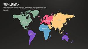
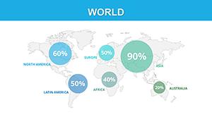
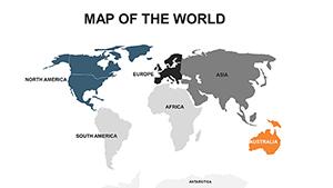
Maps aren`t just tools for navigation; they`re storytelling devices that anchor abstract ideas in real places. Our PowerPoint templates leverage this by offering continent-spanning outlines and detailed insets, enabling users to overlay stats like population density or market shares with precision.
Business developers plot expansion opportunities, while historians trace timelines across terrains - all with drag-and-drop simplicity.
In logistics, supply chain maps visualize routes and bottlenecks, optimizing discussions. Environmental scientists use climate overlays to advocate for change, while real estate agents showcase property distributions to buyers.
One consultant transformed a stagnant sales pitch into a dynamic global overview, securing a multi-million deal through visualized market potentials.
PowerPoint`s insert-map feature is basic; our templates add thematic styling, like vintage parchment for historical themes or futuristic grids for tech forecasts. They support animations, such as route traces, that built-ins can`t match, boosting engagement.
This results in presentations that feel custom-crafted, not cookie-cutter.
Pro tip: Link to external data sources for live updates during live sessions.
A tourism board`s interactive Europe map highlighted seasonal attractions, drawing record inquiries. Innovatively, pair maps with timelines for event planning, showing venue progressions.
From disaster response simulations to cultural exchange programs, these templates adapt to inspire action worldwide.
Navigate to success - select your map template and embark on a visual voyage.
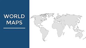
From global overviews to detailed U.S. states, Europe countries, and Asia provinces - comprehensive coverage.
Yes, text boxes and shapes allow easy addition of cities, stats, or notes.
Absolutely, use PowerPoint`s path animation for routes like trade flows or migrations.
Vector-based for sharp prints up to poster size.
Link to Excel for dynamic updates from global datasets.
Copyright © 2009-2026 ImagineLayout All rights reserved.