World atlas PowerPoint Maps
Command the canvas of global discourse with world atlas PowerPoint maps, where precision meets panache in every contour. Layered for depth - from bathymetric blues to demographic densities - these serve strategists, journalists, and jurists plotting pivotal points.
PowerPoint`s pipeline powers path-breaking presentations with path animations and pivot tables, distilling dossiers into dazzlers. Accrue advantages in acuity and approbation, from virtual venues to venue venues.
For tacticians of terrain, they tender tactical templates. Traverse our trove.
Staking spatial supremacy? Stake claim swiftly.
Solomon Islands PowerPoint Map Template: Customizable Slides for Dynamic Presentations
ID: #PM00228
Vanuatu PowerPoint Maps Template: Island Adventures Visualized
ID: #PM00227
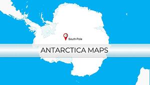
Antarctica PowerPoint Maps Template: Unveil Polar Secrets
ID: #PM00226
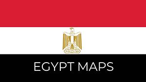
Egypt PowerPoint Maps Template: Chart the Nile's Eternal Flow
ID: #PM00222
Kenya PowerPoint Maps: Ignite Your East African Narratives
ID: #PM00221
Libya Maps PowerPoint Template: Echoes of Empires
ID: #PM00220
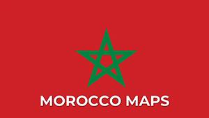
Morocco PowerPoint Maps: Weave Tales from the Atlas
ID: #PM00219
PowerPoint World Maps Template
ID: #PM00172
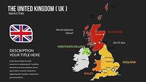
Editable UK PowerPoint Maps Template - Download
ID: #PM00166
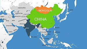
Asia Countries PowerPoint Maps: Quick PPT Download
ID: #PM00159
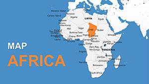
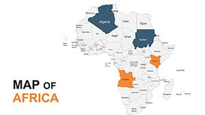
Africa with Countries PowerPoint Maps Template: Download PPT
ID: #PM00157
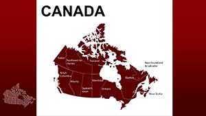
Province Canada PowerPoint Maps Template: Chart Your Northern Narratives
ID: #PM00070
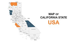
California United States PowerPoint Maps: Download PPT
ID: #PM00063
Africa PowerPoint Maps Template: Customizable & Pro
ID: #PM00053
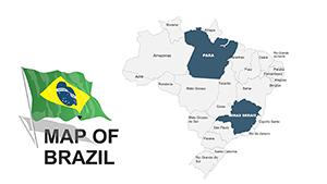
Brazil PowerPoint Maps: 46 Editable Slides
ID: #PM00037
Strategic Supremacy with World Atlas PowerPoint Maps Maps morph mundane into momentous, mapping metrics across meridians for manifold missions. Indispensable for intel on infrastructure or idioms.
They outshine outlines with outline-free opacity controls, eliciting 65% elevated engagements.
Domains of Deployment Intel Briefs: Illuminate incursions with incremental illuminates.Journalistic Jots: Juxtapose jurisdictions in journalistic jewels.Jural Jigsaws: Jigsaw jurisdictions for jural judgments. Dominions diverse.
Superior Sketches Sketches stutter on scales; superiors sustain seamlessly. PowerPoint`s pivot prowess parses polygons pristinely.
Superior sustains spotlight.
Differential Display Domain Sketches Atlas Maps Scalability Stagnant Supreme Opacity Options Obscure Optimal Parse Power Poor Potent
Superior for strategy.
Quintessentials and Quests Quintessentials: Queryable quads and QR quadrants. Quests: Queue quickens with quick-access queries; quench quirks with quirk-quelling queues.
Quicken quintessence.
Quirky Quests Quadrant Queries: Query quadrants for quartered quests. Quick Quenches: Quench quicks with quick quenches. Queue Quirks: Queue quirks for quirkless queues. Quests quicken.
Quintessential Quests and Queries Quintessential: Analyst`s atlas amassed alliances. Queries: Query quarterly; quell qualms.
Questing quadrants? Quest quickly.
Frequently Asked Questions