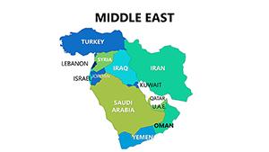
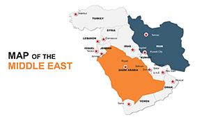
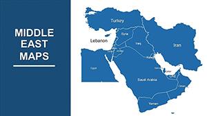
Capture the essence of the Middle East`s dynamic landscapes in your PowerPoint sessions with our refined map templates. Envision tracing the Euphrates through Mesopotamia or spotlighting innovation hubs in Qatar - these slides equip you to do so with finesse. Suited for journalists unpacking conflicts, traders monitoring routes, or developers pitching infrastructure, they blend accuracy with artistry.
Vector-driven and user-friendly, customization is a breeze: Reshape borders, infuse datasets, or sync with SmartArt for holistic views. Transcend plain diagrams; these maps propel engagement, making abstract concepts tangible and memorable.
Our assortment offers granular details for nations like Jordan or broad sweeps of the Fertile Crescent. Plug into PowerPoint effortlessly for quick iterations and flawless renders. Forge connections that linger long after the last slide.


In the heart of global affairs, Middle East maps in PowerPoint become indispensable for dissecting influences from the Persian Gulf to the Mediterranean. Our templates empower this, facilitating overlays of migration stats on Syrian frontiers or renewable energy potentials in Morocco with unmatched poise.
Outpacing PowerPoint`s rudimentary tools, which demand constant realignments, ours feature locked proportions and theme-responsive colors, slashing revision rounds dramatically.
Emphasize relevance: Cluster related areas with grouping tools, apply textures for terrain variety, and rehearse with presenter view for confident cues. Opt for orthographic projections to minimize distortions in spherical depictions.
Spotlight a triumph: An energy trader mapped rig locations across Kuwait, animating production ramps - the demo sealed a multimillion deal by clarifying expansion viability.
Advance your arsenal. Scan our Middle East PowerPoint offerings and integrate prowess into your workflow.
Hybridize with flowcharts to depict refugee aid pipelines or attach pivot tables for drilling into economic strata. For virtual events, leverage hyperlinks to 360-degree site spins, enriching remote audiences.
In boardrooms, incorporate sentiment gauges over public zones, quantifying opinion shifts post-events for sharper strategies.
Stock images degrade under scrutiny; our assets endure with crisp lines and bundled legends for instant legibility. Optimized for collaboration via OneDrive, they facilitate team tweaks without version chaos.
Voices affirm: "Transformed my trade analyses from mundane to mesmerizing," lauds a broker. An archivist shares, "Revived dusty lectures with these precise, pliable visuals."
Lead with luminosity. Grab your maps now and illuminate informed paths.
Copyright © 2009-2026 ImagineLayout All rights reserved.