Denmark PowerPoint Maps
Bring Denmark to life in your presentations with our fully editable PowerPoint maps. Capture Copenhagen vibrant coasts and Jutland landscapes with precision and style.
Perfect for businesses educators and travel professionals these templates allow detailed region highlighting pins labels and stats without design compromise.
Norway PowerPoint Maps Template: Download PPT
ID: #PM00191
Netherlands PowerPoint Maps - Download Template
ID: #PM00190
Belgium PowerPoint Maps Template: Chart European Elegance
ID: #PM00178
Editable EU Maps PowerPoint Template: 61 Slides
ID: #PM00175
EU Countries PowerPoint Maps Template - High-Quality PPT
ID: #PM00174
EU PowerPoint Maps Template - Customizable & Detailed
ID: #PM00173
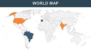
World Country Maps PowerPoint Template: Unlock Global Insights
ID: #PM00169
Editable World Map PowerPoint Template
ID: #PM00167
World Countries PowerPoint Maps: Chart the Globe with 65 Editable Masterpieces
ID: #PM00061
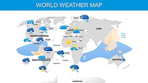
Weather and Climate Maps for PowerPoint: Forecast Your Message with Precision
ID: #PM00060
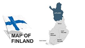
Finland Maps for PowerPoint: 44 Custom Slides
ID: #PM00041
Editable Denmark PowerPoint Maps: Precision Mapping for Nordic Narratives
ID: #PM00035
Editable Europe PowerPoint Maps: Charting Success Across the Continent
ID: #PM00034
Europe Map PowerPoint Template for Regional Insights
ID: #PM00030
Why Choose Denmark PowerPoint Maps Our Denmark maps turn static slides into engaging visual stories. Use them for market analysis tourism campaigns or educational projects.
Professional Applications Business Expansion Shade regions by market potential for strategic insights Tourism Promotions Pin attractions like Legoland or Little Mermaid for itineraries li>Educational Modules Highlight historical Viking routes and cultural sitesAdvantages Over Standard Templates Fully editable regions for precise customizations Layered elements for animation and data integration Vector-based sharp graphics scalable to any slide size Creative Tips and Best Practices Use color coding to highlight regional trends Integrate spreadsheet data for live updates Animate key regions for audience focus Start creating impactful Denmark presentations today. Choose your map and elevate your slides effortlessly.
Frequently Asked Questions Can I customize each region individually? Yes each region is fully editable allowing custom colors labels and data for precise presentations.
Are these maps compatible with all PowerPoint versions? Yes they work seamlessly across all modern PowerPoint versions on Windows and Mac.
Can I use these maps for marketing presentations? Absolutely perfect for business marketing reports regional sales analysis and campaign planning.
Do these maps include major cities and landmarks? Yes key cities regions and landmarks are included for detailed storytelling.