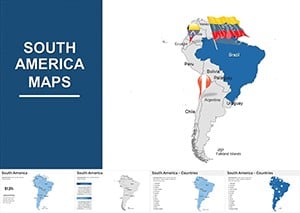
Map out global narratives with our continents Keynote map templates. Aimed at educators, travel enthusiasts, and international business leaders, these templates provide precise, editable representations of world regions. From continental overviews to country-specific zooms, they facilitate storytelling that spans borders.
With layered vectors and annotation tools, they support dynamic explorations - highlight trade routes or climate zones effortlessly. Ideal for classroom lessons, market expansions, or adventure planning, these maps blend accuracy with visual appeal for impactful delivery.
Simplify geography in slides - our collection offers instant scalability and theme integration. Venture into templates that make the world your canvas, fostering understanding one continent at a time.

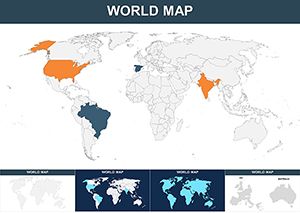
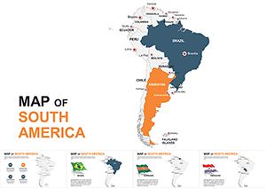
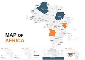
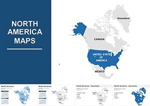
These maps outpace basic clipart by featuring topographic details and political boundaries in editable vectors, allowing custom shading for demographics or exports. Such fidelity aids comprehension, with visuals proven to enhance spatial learning by 70%.
Teachers animate continental drifts for history classes, revealing tectonic evolutions. Exporters visualize supply chains, linking ports across Asia and Europe in interconnected nodes. Tour operators plot itineraries, embedding photos in region hotspots for immersive previews.
Better than static images, they include projection options for distortion-free views and accessibility tags. Practices: Use consistent scales, incorporate legends for clarity, and animate reveals for guided tours.
Customize by merging datasets - import CSV for population bubbles that resize dynamically. Success story: A logistics firm cut planning time by 40% with our "TerraLinks" template, where animated routes simulated shipping efficiencies across continents.
Adapt for climate reports, layering weather patterns over landmasses, or in diplomacy, abstracting alliances in alliance webs. These tools turn flat facts into exploratory adventures.
Ready to globe-trot in slides? Browse and download a map template that charts your course. Connect continents, ignite curiosity, and present the world anew.
Mercator, Robinson, and azimuthal options, selectable for minimal distortion in presentations.
Yes, hyperlink regions to details or use builds for sequential continent highlights.
Vector-based, so paths can be adjusted for disputed areas or thematic groupings.
Seamlessly, with shape paths animatable to simulate movements like continental drift.
From Excel imports for stats to image layers for satellite views, all compatible.
Select templates offer eras like pre-colonial or post-WWII for temporal comparisons.
Copyright © 2009-2026 ImagineLayout All rights reserved.