Present Central America with clarity and confidence. This collection of Central America PowerPoint map templates is designed for presenters who need geography to support their story not distract from it. From country level overviews to detailed regional layouts these slides help you explain location based data strategies and trends in a way audiences instantly understand.
Each template is fully editable in PowerPoint so you can adjust colors labels icons and data markers to match your brand or project. Whether you are preparing a business expansion report an educational lesson or a tourism presentation these maps give you a professional starting point that saves hours of design work.
Use clean vector shapes clear typography and balanced layouts to keep the focus on your message. With modern styles and practical layouts these Central America maps work equally well in corporate boardrooms classrooms and conference stages.
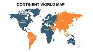
Continent World PowerPoint Maps: Global Visualization Made Simple
ID: #PM00065
$22.00
(228)
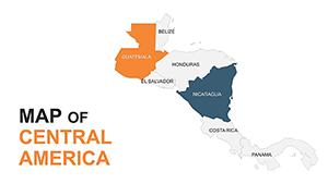
Central America Editable Maps: Tropical Visions Unleashed
ID: #PM00051
$35.00
(136)
Asia Map PowerPoint Template - Emerging Markets Focus
ID: #PM00032
$48.00
(667)
USA PowerPoint Maps Template: 36 Editable Slides
ID: #PM00023
$45.00
(217)
Globalize Your Designs with Central America PowerPoint Maps
ID: #PM00011
$44.00
(19)
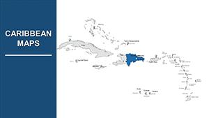
Editable Caribbean Islands PowerPoint Maps: Transform Your Presentations with Geographic Precision
ID: #PM00010
$30.00
Why use Central America PowerPoint map templates
Maps are powerful visual tools but only when they are clear and well designed. Default slide maps often look outdated or lack flexibility. Our Central America PowerPoint maps are built specifically for presentations so every element is easy to edit and visually consistent.
Show country by country comparisons across Central America
Highlight trade routes logistics hubs or market regions
Visualize tourism flows travel plans or cultural topics
Support lessons in geography economics or history
Real world use cases
Business and corporate reports
Use Central America maps to present market entry plans regional sales performance supply chain coverage or partner locations. Clear color coding and icons help decision makers grasp complex regional information in seconds.
Education and training
Teachers and trainers can explain geography political boundaries and regional relationships more effectively with visual maps. Editable labels allow you to adapt slides for different age groups or learning goals.
Marketing and tourism presentations
Show destinations routes and regional highlights when pitching travel products tourism strategies or cultural projects. A well designed map instantly builds trust and interest.
Benefits compared to default PowerPoint maps
Modern design suitable for professional presentations
Fully editable vector shapes and text
Consistent color palettes and typography
Layouts optimized for screens and projectors
Creative tips for better map slides
Limit colors to three or four to keep the map readable
Use icons instead of long text labels where possible
Add subtle animations to guide attention step by step
Combine maps with charts for deeper insights
Explore the collection and build your Central America presentation faster. Choose a template customize it in minutes and focus on delivering your message.
Frequently asked questions
Are these maps editable in PowerPoint
Yes all elements including shapes colors and labels can be edited directly in PowerPoint.
Can I use these templates for commercial projects
You can use them in client presentations company reports and marketing materials.
Do the maps include all Central America countries
Yes the templates cover all Central America countries with clear boundaries.
Are these suitable for educational use
Absolutely they are designed to be clear and easy to adapt for teaching.