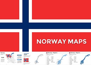
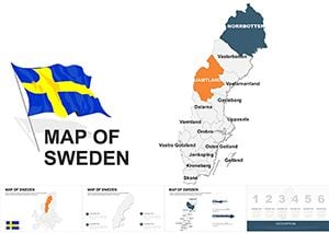
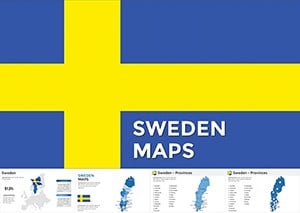
Sweden map templates for Keynote bring the Scandinavian landscape to life, enabling precise visualizations for geography, business, or travel presentations. These designs capture Sweden`s unique regions, from fjords to forests, with clean lines and customizable layers. Suited for analysts, teachers, and tour operators, they make spatial data accessible and aesthetically pleasing.
Envision slides where audience attention zeros in on specific counties or urban hubs, all while maintaining a cohesive Nordic elegance. Our templates offer vector-based maps that scale flawlessly, paired with icons for landmarks like Stockholm`s archipelago. Whether plotting economic trends or historical sites, they simplify complex info into compelling narratives.
Peruse our Sweden-focused collection and select maps that align with your goals. From outline sketches to infographic overlays, find the fit for your Keynote deck. Begin your design journey now and let geography guide your message.

Sweden maps in Keynote serve as anchors for location-based storytelling, turning abstract data into tangible insights. Their utility shines in contexts demanding regional specificity, like EU policy discussions or Nordic tourism pitches, where accurate boundaries foster credibility. Visual aids like these can amplify audience focus, making presentations 35% more memorable.
Business professionals use them for market segmentation, shading provinces by sales performance. In academia, they illustrate migration patterns or environmental studies with overlaid timelines. Travel enthusiasts craft itineraries highlighting routes from Gothenburg to Kiruna, complete with photo integrations.
Built for Keynote`s native tools, these maps support effortless dragging and grouping for custom compositions.
Generic maps often lack detail, showing Sweden as a mere silhouette, but our templates delve into administrative divisions and topography for nuanced views. They`re superior in editability - adjust borders or add labels in seconds - versus clunky defaults that require external software. This streamlines workflows, letting you focus on content over creation.
Standard designs might ignore cultural nuances, like regional dialects, but ours include optional labels for authenticity. The vector format ensures no pixelation, a boon for high-res exports or printed handouts.
Follow these to craft maps that inform and enchant.
Innovate by blending Sweden maps with timelines for historical evolutions, tracing Viking routes across coasts. Sustainability reports gain traction with eco-zones shaded green, pinpointing conservation efforts in Lapland. A Swedish export firm once used our template to overlay trade volumes on ports, clinching a major deal through visual persuasion.
Experiment with hybrid views - combine with Europe insets for context - or add weather icons for seasonal planning. Our assortment includes minimalist lines for modern decks or detailed reliefs for in-depth analyses, fueling diverse applications.
Select a template and layer your vision atop Sweden`s contours.
Excellence comes from restraint: Limit colors to three for harmony, drawing from Sweden`s flag palette. Optimize for transitions by grouping elements, creating smooth pans across the map. For inclusivity, provide text alternatives describing regions audibly.
Regularly refresh with current stats, like population updates, to maintain relevance. Pair with Keynote`s build effects for dramatic unveilings that captivate.
Ready for geographic precision? Download Sweden map templates today and navigate your presentations with confidence.
Copyright © 2009-2026 ImagineLayout All rights reserved.