Infuse your Keynote presentations with a precise map of North America, crafted for clarity and elegance. Suited for strategic overviews or exploratory sessions, these templates distill vast information into digestible visuals.
For designers, policymakers, and lecturers, they enable quick adaptations - recoloring territories or annotating trade corridors. Harness Keynote`s polish for standout results.
Scalable vectors adapt to any canvas, preserving integrity in exports or shares. Let geography amplify your voice.
Check out our map of North America in Keynote and spark your next breakthrough. Instant download awaits.


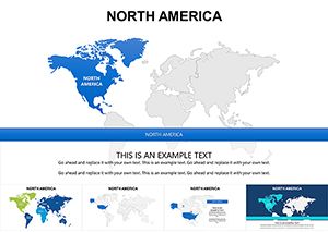
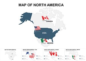
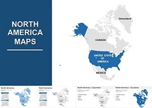
The map of North America in Keynote becomes a canvas for innovation, with subtle gradients evoking terrains from prairies to peaks. Surpassing built-in options, it equips you for sophisticated discourse.
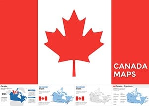
Diplomats sketch alliance networks; artists conceptualize cross-continental exhibits. Precision meets artistry here.
Policy analysts delineate regulatory zones, clarifying compliance landscapes. In publishing, map book tours, engaging readers spatially.
Adventure guides outline expeditions, building excitement through mapped adventures. Depth distinguishes these from basics.
Techniques that polish to perfection.
Unleash creativity by merging maps with Keynote charts for holistic views, like economic corridors. Activists plot equity gaps, galvanizing change.
Custom projections cater to thematic needs, such as polar views for arctic focus. Versatility fuels ingenuity.
Eager to experiment? Access map of North America Keynote templates and download for discovery.
Fuse with photos for hybrid slides, like overlaid cityscapes. Curators map exhibit flows, guiding virtual tours.
For wellness, trace wellness retreats, promoting balance geographically. Expansions enrich engagement.
Visualize boldly. Grab your map of North America in Keynote today and innovate.
Copyright © 2009-2026 ImagineLayout All rights reserved.