Present Ireland with confidence using professionally designed Keynote map templates created for clear storytelling and fast editing.
Each layout focuses on readability accurate geography and visual balance so your audience instantly understands regions cities and data points. These templates help you turn complex location based ideas into clean persuasive slides without spending hours on design.
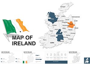
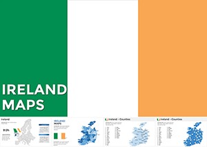
Ireland focused map slides are ideal when location matters. Instead of generic shapes you get layouts designed around the real structure of the country including regions cities and visual markers that support data driven stories. This makes your presentation look intentional polished and professional from the first slide.
These templates are created for consultants teachers analysts startups and public speakers who need clarity and speed. Every slide is fully editable in Keynote so colors text icons and labels can be adjusted in seconds to match your brand or message.
Ireland map Keynote templates work across many scenarios. In business reports they help visualize regional performance sales coverage or logistics routes. In education they support geography history and economics lessons. Marketing teams use them to explain market reach event locations or expansion plans.
Government and nonprofit presentations also benefit from clear regional visuals when sharing statistics development plans or community impact stories.
Default presentation maps often look flat outdated or unclear. These templates offer stronger contrast balanced spacing and thoughtful visual hierarchy. The result is a slide that guides the eye and supports your spoken message instead of distracting from it.
Use highlights sparingly to draw attention to key regions. Combine icons with short labels instead of long text blocks. Keep color palettes consistent across slides to maintain a professional flow.
For data heavy slides pair maps with simple charts or callouts. This keeps information digestible while adding visual interest.
Download an Ireland Keynote map template and build location focused slides faster with confidence and clarity. Perfect for modern presentations that need to look professional right away.
Yes all elements including maps colors text and icons can be edited directly in Apple Keynote.
Absolutely they are designed for professional use in reports pitches and meetings.
Most layouts include key cities and allow you to add or remove labels as needed.
Copyright © 2009-2026 ImagineLayout All rights reserved.