Discover our professional Keynote map templates designed to transform your presentations into engaging visual journeys. Fully editable and interactive these maps bring data to life with smooth animations and layered details.
Perfect for business strategists educators and travel planners our templates allow easy plotting of routes pins and geographic highlights. Enhance clarity and audience engagement with visually rich layouts ready for your content.
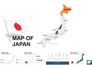
Japan Editable Maps Keynote Template: Eastern Horizons Unveiled
ID: #KM00047
$54.00
(214)
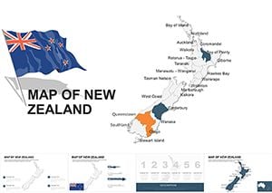
New Zealand Editable Maps Keynote Template: Islands of Innovation Unveiled
ID: #KM00045
$52.00
(106)
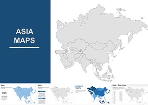
Editable Political Asia Map Keynote Template: Visualize Geopolitical Dynamics
ID: #KM00026
$55.00
Why Choose Our Keynote Map Templates
Our Google-inspired Keynote maps combine aesthetic precision with practical utility. Unlike standard maps they are fully editable vector files supporting dynamic animations and interactive layers.
Real-World Use Cases
Business Reports: Visualize market expansion competitor analysis and regional performance
Education: Present historical events geography lessons or demographic studies
Travel Planning: Map itineraries highlight attractions and logistics
Marketing Presentations: Plot sales territories or campaign reach
Benefits Over Default Templates
Editable layers enable customized data visualization. Animations capture attention and live Google integration keeps maps current. Unlike default templates these designs are versatile for professional use.
Creative Tips and Best Practices
Use color gradients to show density or importance
Incorporate icons and pins for key locations
Maintain clear legends and labels for readability
Combine multiple map layers for interactive storytelling
Start creating compelling presentations today. Choose a template and plot your data effectively.
Frequently Asked Questions
Can I edit the map regions and colors?
Yes all map regions and colors are fully editable to match your branding or presentation needs.
Are these templates compatible with the latest Keynote version?
All templates are tested and fully compatible with Keynote 2026 ensuring smooth animations and edits.
Can I use these maps for business presentations?
Absolutely these templates are designed for professional use including business strategy marketing and reporting.
Do templates include world and regional maps?
Yes the collection covers global regions countries and detailed city maps for versatile presentation needs.
Is it possible to integrate live Google Maps links?
Yes you can embed live Google Maps links for real-time updates and interactive presentations.