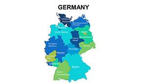
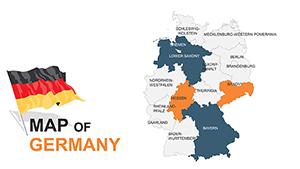
Our Germany map templates for PowerPoint are engineered for those who value detail and flexibility in their visual aids. From the industrial heartland of North Rhine-Westphalia to the vineyards of Rhineland-Palatinate, these maps provide a comprehensive canvas for your geographic narratives.
Fully scalable and color-adjustable, they allow seamless integration of statistics, routes, or annotations. Ideal for sales teams mapping territories or historians charting eras, these designs ensure your points land with authority and style.
Peruse our offerings and choose the map that aligns with your vision. Turn geographical data into persuasive visuals that command attention - begin your customization journey today.


PowerPoint`s robust editing suite pairs perfectly with our Germany maps, offering superior control over standard imported images that pixelate upon resizing. Each state is a separate object, ripe for individual styling - think gradient fills for elevation or patterns for economic sectors. This granularity empowers users to craft nuanced visuals that reveal patterns at a glance.
In corporate environments, these maps shine for logistics planning, displaying supply chains across federal borders. Travel agencies use them to outline itineraries, embedding photos and notes for immersive pitches. The difference from basic templates? Ours include alignment guides and shadow effects for a polished, three-dimensional feel without extra plugins.
These scenarios illustrate the maps` broad appeal in driving home key messages.
Leverage PowerPoint`s morph transition to animate map evolutions, like shifting political boundaries over time - a feature absent in rigid defaults. Pro advice: Group elements for batch edits, saving hours on large projects. A logistics company recently mapped distribution networks with our template, streamlining operations and impressing stakeholders.
Likewise, an urban planner visualized city expansions, using layered transparency to show future projections. Such innovations make our templates indispensable for forward-thinking creators.
These methods yield professional-grade outcomes with ease.
From schematic to artistic styles, find the Germany map that sparks your creativity. Instant access awaits - empower your PowerPoint decks with geographic excellence now.
Copyright © 2009-2026 ImagineLayout All rights reserved.