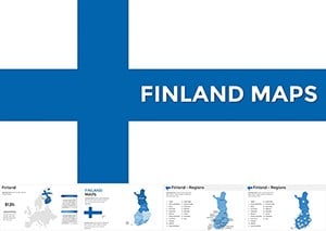
Our Finland map Keynote templates offer a gateway to visualizing the Land of a Thousand Lakes with elegance and accuracy. Tailored for educators, travel planners, and business analysts focusing on Scandinavian markets, these designs feature crisp outlines of regions like Lapland and Helsinki, plus customizable pins for key sites.
Effortlessly layer demographic data or tourism stats over high-fidelity maps, creating slides that inform and captivate. Built for Keynote`s robust tools, they support smooth zooms and annotations, ideal for interactive sessions.
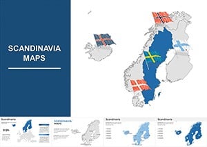
Whether mapping economic hubs or cultural landmarks, these templates streamline your workflow. Peruse the assortment to pinpoint the ideal base for your narrative.
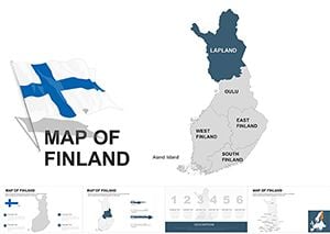
Finland`s unique topography - from fjords to forests - demands visuals that honor its subtlety. Our Keynote templates deliver through scalable SVG paths, enabling precise edits like shading for population density or routes for travel itineraries. This precision outshines pixelated imports, preserving detail at any zoom.
Geography teachers employ them for lesson plans, overlaying climate zones on base maps. Travel agents craft bespoke tours, marking saunas and aurora spots dynamically. Businesses targeting Finnish exports use them for supply chain overviews, linking ports to production centers.
Standard maps often lack editability; ours integrate seamlessly with Keynote`s magic move for fluid transitions between overview and detail views.
Prioritize legend clarity: Position keys off-map for uncluttered views. Use consistent projections to avoid distortion in northern latitudes. For interactivity, hyperlink regions to pop-up facts - perfect for remote audiences.
Innovative use: Pair Finland maps with weather icons for climate impact studies, or embed 360-degree links for virtual tours.
Our 15+ variants cover everything from minimalist to ornate. Secure yours and navigate presentations flawlessly.
A Nordic heritage festival organizer mapped event venues, drawing 2,000 attendees with intuitive layouts. An eco-consultant visualized reforestation zones, influencing policy with stark before-after contrasts.
Apply to heritage talks, tracing Sami territories with cultural motifs.
| Element | Generic Maps | Our Keynote Designs |
|---|---|---|
| Resolution | Low-Res | Vector Sharpness |
| Regional Detail | Basic | Province-Level |
| Animation Support | None | Built-In Paths |
| Customization | Limited | Full Path Editing |
Experience the upgrade - browse and download to chart your course.
Need tailored advice? Our collection is ready - download and explore Finland`s contours.
Copyright © 2009-2026 ImagineLayout All rights reserved.