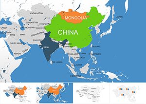
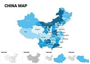
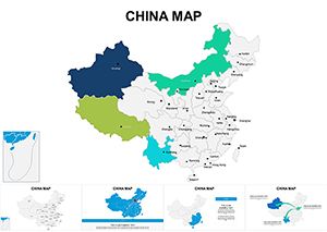
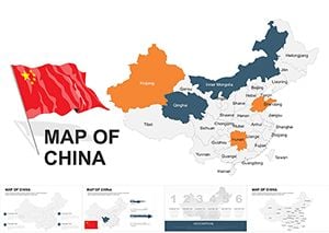
China`s expansive terrain, from the Great Wall`s northern reaches to the pearl rivers of the south, inspires awe and demands sophisticated visuals. Our Keynote map templates cater to executives, educators, and cultural enthusiasts seeking to convey complex narratives effortlessly. These designs capture the nation`s 34 provinces with elegant simplicity, enabling data overlays on economic hubs like Shanghai or historical sites in Xi`an.
Built for Apple`s Keynote, they leverage smooth animations and high-fidelity graphics for seamless storytelling. Edit paths for trade routes, color-code for population densities, or embed hyperlinks to deepen engagement. The result? Presentations that resonate globally.
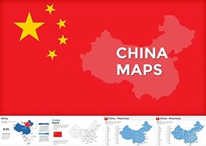
Browse our library of China Keynote maps and choose layouts that align with your vision. Quick downloads get you creating impactful slides without delay.


From boardrooms to classrooms, these templates illuminate China`s multifaceted landscape.
Such versatility ensures your content connects deeply with diverse audiences.
Conventional maps in Keynote often suffer from low resolution or inflexible shapes, complicating updates. Our templates use native vector paths for crisp zooms and effortless resizing, outpacing pixel-heavy alternatives that blur on export.
A standard slide might limit to outlines; ours include layered data sets - demographics, infrastructure - toggleable for tailored views. This depth saves revision time and enhances professionalism, as seen in smoother transitions that hold attention longer.
Celebrate innovation with features like gradient fills mimicking terraced rice fields, icon libraries of pagodas and pandas, and build-in transitions for narrative flow. Accessibility shines through with descriptive tags and color-blind modes.
Best practices: Anchor maps to themes for consistent styling, use hyperlinks for source citations, and rehearse timings to sync with speaker notes. These strategies amplify memorability.
Layer strategically: Background for context, foreground for focus points like the Yangtze Delta. Employ builds to unveil stats progressively, building suspense. Test on external displays for color accuracy.
Integrate multimedia - embed audio of traditional erhu for cultural slides. Track engagement via Keynote`s presenter display, refining based on pauses.
For global appeal, include pinyin labels alongside characters. This thoughtful preparation elevates ordinary decks to extraordinary.
Capture China`s essence - select and download your China Keynote map template today.
Yes, ensuring sharpness at any zoom level without quality loss.
Certainly - Keynote`s tools allow timing and effect adjustments per element.
Indeed; link charts directly to Excel for real-time updates.
All 23 provinces, 5 autonomous regions, 4 municipalities, and 2 SARs.
Templates are backward-compatible to Keynote 2019 and later.
Copyright © 2009-2026 ImagineLayout All rights reserved.