Journey across the vast landscapes of Australia with our specialized Keynote map templates. These dynamic designs capture the continent`s diverse terrains - from rugged Outback to coastal gems - making geography lessons and travel pitches unforgettable.
Geared toward teachers, tour guides, and business travelers, the templates feature layered maps with editable states, cities, and landmarks. Animate paths for migration routes or highlight zones for market analysis, all within Keynote`s fluid interface.
Core perks: Vector precision for zoomable details, thematic icons for indigenous sites, and color gradients evoking eucalyptus hues. Simplify complex spatial data into engaging narratives that stick.
Chart your course Down Under. Peruse our Australia Keynote map templates and download to map your success story.


Maps in presentations can be dry, but our Keynote templates infuse Australia`s essence with interactive flair. Default outlines pale against our textured terrains and pop-up labels, turning static views into exploratory adventures.
For a wildlife tour overview, animate kangaroo icons hopping across the Nullarbor - captivating audiences instantly. Educators leverage them for history classes, tracing colonial paths with timeline overlays.
Superior to basic shapes, ours boast GPS-compatible coordinates and shadow effects for 3D depth, enhancing perceived sophistication.
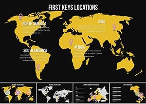
Effective mapping tells stories. Our templates include legend builders for custom keys and heat maps for population densities. In environmental talks, shade drought areas to underscore climate impacts vividly.
Guidelines: Limit pins to essentials for clarity, and use transitions to reveal layers progressively. Integrate photos via hyperlinks for immersive detours to sites like the Sydney Opera House.
Success story: A real estate firm mapped property hotspots, securing three major deals post-presentation thanks to intuitive regional breakdowns.
Delve into specifics with city insets or elevation profiles. For conferences, sync with live data for current weather visuals. Creatives blend maps with Aboriginal art motifs, honoring heritage while innovating.
This adaptability makes them indispensable for global audiences, fostering appreciation for Australia`s unique geography.
Explore the red center - select a template and navigate to brilliance.
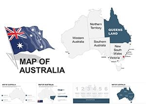
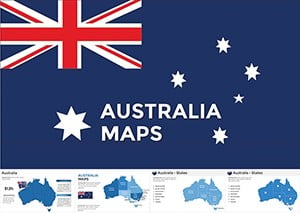
All states and territories, including detailed views of Northern Territory, Queensland, and Tasmania.
Yes, built-in paths animate smoothly, ideal for travel timelines or historical migrations.
Over 50, from the Harbour Bridge to wine regions, all vector-scalable.
Use Keynote`s shape tools to pin and label, with smart guides for alignment.
Fully, with touch-optimized layers for mobile editing and presenting.
Standard, with easy toggles for distances in kilometers or miles.
Copyright © 2009-2026 ImagineLayout All rights reserved.