3D Earth's Core PowerPoint Shapes Collection


Envision captivating your class or colleagues with a vivid cross-section of the planet, peeling back layers to reveal the mysteries beneath our feet. This 3D Earth's Core PowerPoint Shapes collection offers 13 editable slides that bring geological wonders into sharp focus, ideal for scientists detailing seismic activities or teachers explaining mantle dynamics. With full compatibility across PowerPoint 2013 and beyond, plus easy import to Google Slides, these shapes let you manipulate perspectives and details effortlessly, turning technical data into accessible stories.
Essential Features for Immersive Visuals
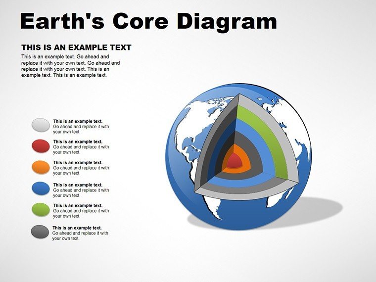
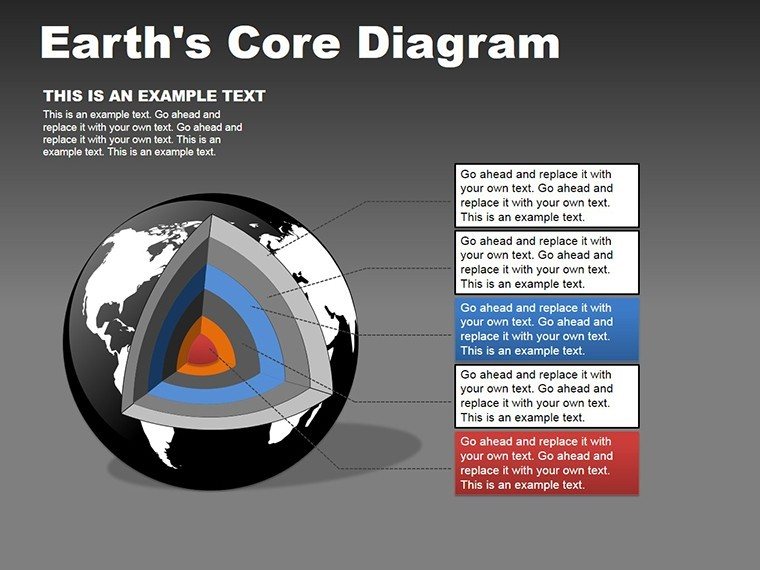
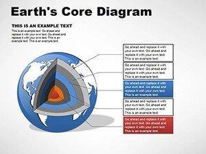
These shapes harness three-dimensional rendering to provide depth and realism, with options for rotating views or zooming into specific layers. Color palettes mimic natural strata - fiery reds for the core, earthy browns for the crust - yet remain fully adjustable to emphasize educational points, like contrasting temperatures. Styles range from static cutaways to animated sequences, allowing progressive reveals that build understanding layer by layer.
Exploring the Slide Set
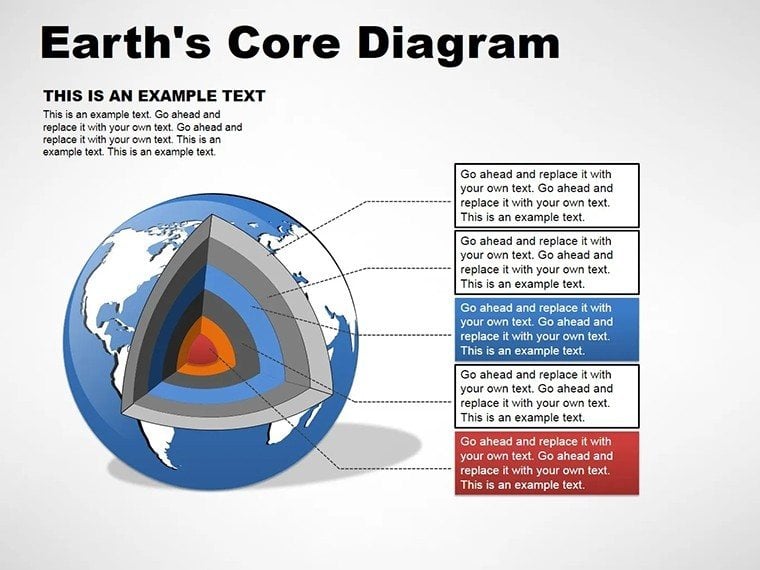
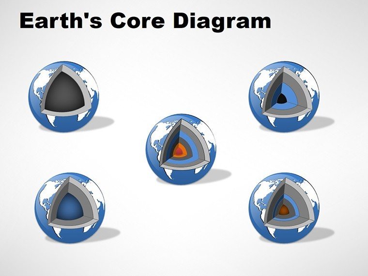
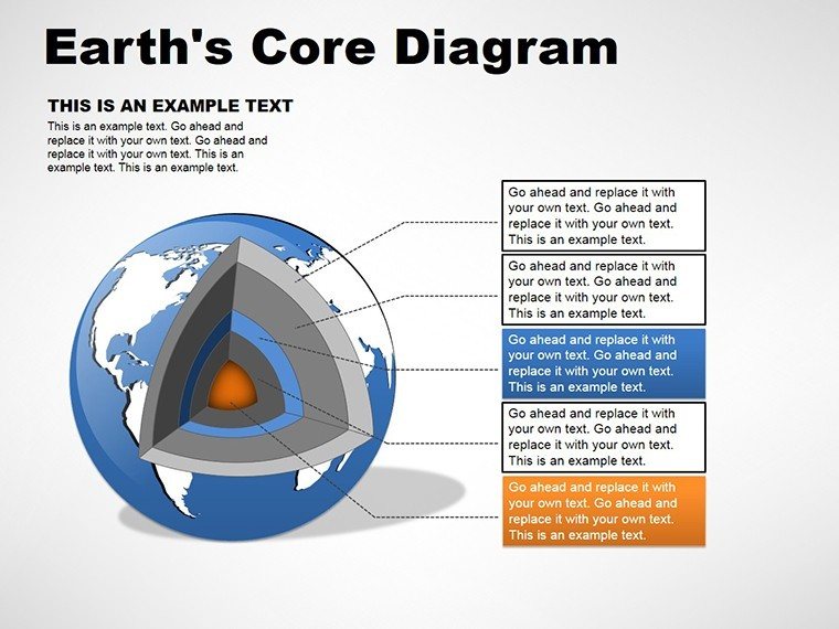
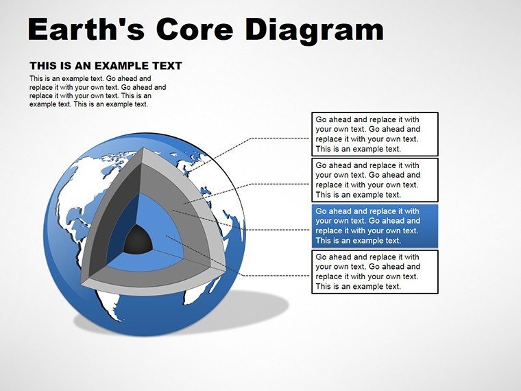
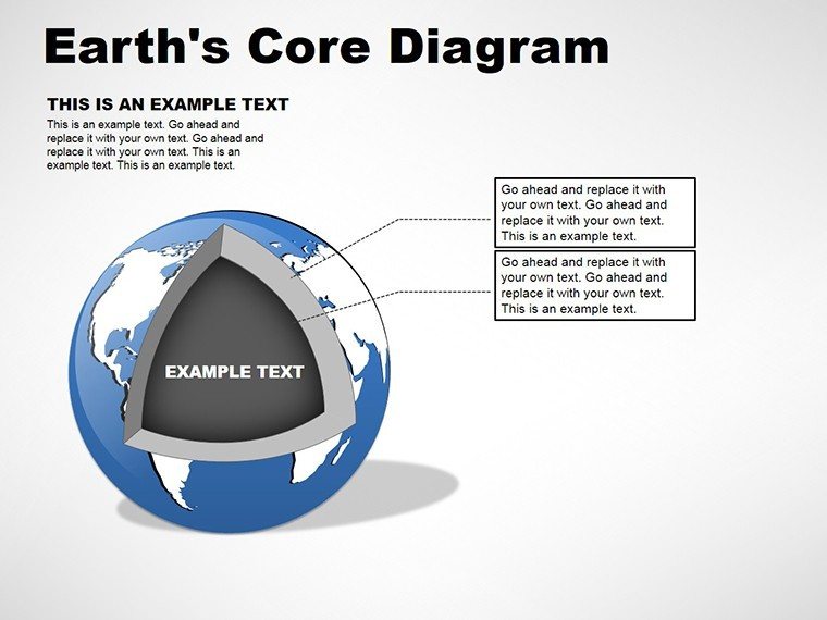
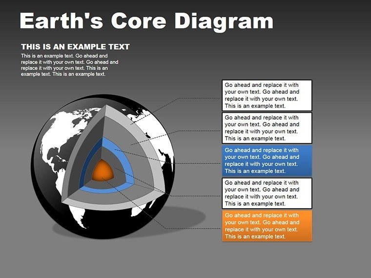
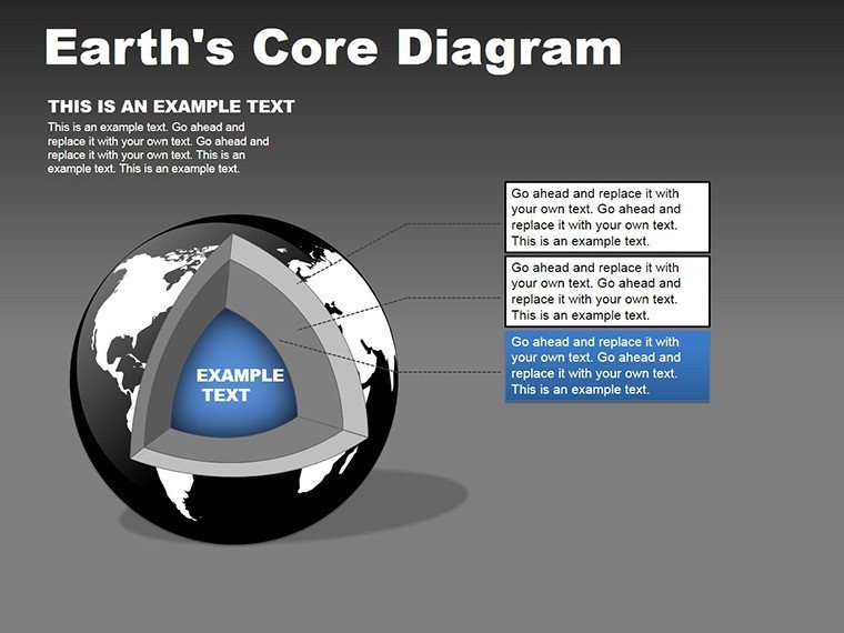
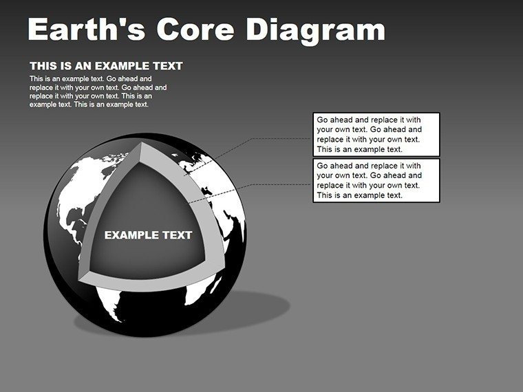
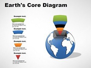
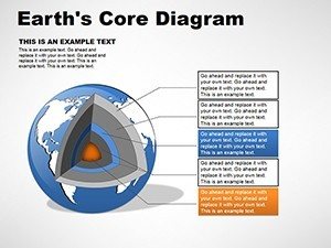
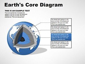
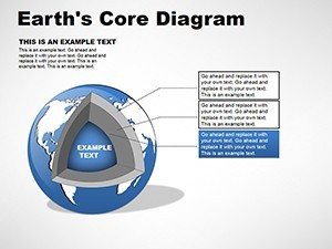
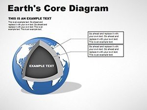
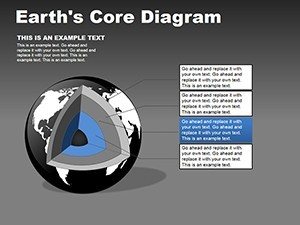
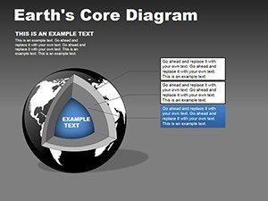
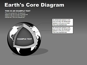
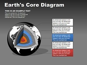
Slide 1 showcases a full 3D globe with a transparent slice, setting the stage for overviews in introductory geology sessions. Slide 2 zooms inward to the inner core, with metallic textures highlighting its solid iron composition. Slide 3 depicts the outer core's fluid dynamics, complete with flow arrows for convection currents. Slides 4-6 cover the mantle variations: lower mantle density gradients, upper mantle plasticity, and transition zones with phase changes. Slide 7 integrates tectonic plates, animating their movements to illustrate earthquakes or volcanism. Slides 8-10 focus on cross-sections: equatorial, polar, and oblique views for comprehensive analysis. The concluding slides, 11-13, include composite models with labels and legends, suitable for research summaries or exam reviews.
Vector-based construction ensures these shapes scale without distortion, perfect for high-resolution outputs in academic posters or online courses.
Applications in Education and Research
Geophysicists might use these in conference presentations to model core-mantle boundary interactions, clarifying how they influence magnetic fields. In classrooms, instructors can animate plate tectonics to demonstrate continental drift, making historical theories like Wegener's more relatable. Environmental consultants could adapt them for impact assessments, visualizing subsurface effects of mining operations.
Customization Workflow
- Import the template into PowerPoint or Google Slides and select your starting shape.
- Edit layer labels by clicking text boxes, adding specifics like depth measurements in kilometers.
- Modify colors using the eyedropper tool to match scientific diagrams from sources like USGS reports.
- Apply animations - such as spin effects - to simulate rotations, enhancing interactive elements.
- Export or present, ensuring compatibility checks for shared collaborations.
This method aligns with best practices in visual aids, similar to how experts at institutions like the Smithsonian use 3D models to engage visitors with earth's inner workings.
Optimization Tips for Your Shapes
- Focus on contrast: Use distinct hues for adjacent layers to prevent visual merging.
- Incorporate legends: Add key explanations off to the side for quick reference during talks.
- Balance detail: Avoid overloading with too many annotations; prioritize core concepts.
- Test interactivity: If using hyperlinks, link to external resources for deeper exploration.
These strategies ensure your presentations not only inform but also inspire curiosity about our planet's hidden realms.
Prepared to deepen your depictions? Download this 3D Earth's Core PowerPoint Shapes collection and illuminate your topics.
Frequently Asked Questions
How detailed are the 3D renderings?
They include realistic textures and scalable depths, with options for cross-sections and animations.
Does it support collaborative editing?
Yes, especially when imported to Google Slides for real-time team modifications.
What PowerPoint versions are recommended?
PowerPoint 2013 and later for full 3D features and animations.
Can I add my own data overlays?
Certainly, integrate charts or text over the shapes for customized insights.
Is there a limit on modifications?
No, edit freely for unlimited adaptations in various projects.
Are animations included?
Yes, built-in options for revealing layers or simulating movements.