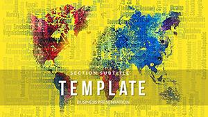
Our PowerPoint templates for maps offer dynamic ways to present geographic information in your slides. Featuring editable world, country, or custom maps, they help visualize data effectively for any audience.
Suited for business analysts, educators, or travelers, these templates allow easy modifications to highlight routes, regions, or statistics. Incorporate colors, labels, and animations to make your points clear and compelling.
Enhance your presentations with professional map visuals that convey complex ideas simply. From strategy sessions to classroom lectures, these designs add value and engagement.
Check out our variety and download templates to elevate your next presentation.


PowerPoint excels at integrating maps for impactful visuals. Our templates provide ready-made geographic frameworks that support data overlays and storytelling.
These tools transform static maps into interactive presentation elements.
In corporate settings, use maps to display sales territories or expansion plans. Educators illustrate historical migrations or environmental changes. Marketers show customer demographics geographically.
Travel presentations highlight itineraries with pinned locations and photos. Non-profits map impact areas for donor reports. Scientific talks use them for ecosystem distributions or climate models.
This flexibility makes maps essential for conveying spatial relationships in diverse contexts.
Basic PowerPoint lacks detailed map assets; our templates fill this gap with accurate, scalable designs. They include legends and scales automatically, unlike manual creations that risk inaccuracies.
Time efficiency is key - start with pre-built maps instead of drawing from scratch.
Standout with 3D effects or interactive hotspots in our templates. Compatibility with data tools like Excel allows real-time updates. Designs cater to global audiences with multilingual support.
Users enjoy the professional aesthetic that boosts credibility in presentations.
These practices ensure maps add value to your narrative.
Create a global business strategy map with animated growth paths. In education, simulate explorations with clickable continents revealing facts.
For events, map venue layouts with navigation aids. These ideas showcase maps` potential for engaging content.
Templates reduce design time, allowing focus on insights. Shareable files facilitate team input, improving final outputs.
Ongoing enhancements keep your maps modern and functional.
Copyright © 2009-2026 ImagineLayout All rights reserved.