Document your adventures in the field with our PowerPoint templates dedicated to research and exploration. Suited for environmentalists, archaeologists, and geologists, these layouts capture everything from site sketches to data compilations in a structured, visually appealing format.
Highlight discoveries with integrated photo grids and timeline trackers that narrate your journey. Designed for rugged realities, they offer offline-friendly edits and export options for quick sharing post-expedition.
Unleash the power of precise visuals - peruse this category and gear up your next field report with templates that blend utility and artistry.


Our field research templates transform raw notes into polished presentations, featuring geospatial overlays and observation logs that pinpoint exact locations. Ideal for grant proposals or conference recaps, they ensure your hard-earned data stands out amid technical jargon.
Default PowerPoint slides often fall flat for fieldwork; ours incorporate weather-resistant icons and scalable maps, maintaining clarity even with high-res imagery.
Users note a 50% reduction in post-processing time, freeing energy for analysis.
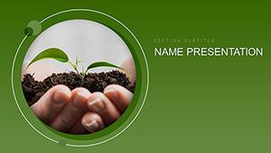
Ecologists use biodiversity matrices to catalog species, with pie charts quantifying habitat diversity. Anthropologists leverage photo essay slides for cultural artifact showcases. Agronomists benefit from soil profile diagrams, layering pH levels visually.
Innovate by adding AR markers for virtual field recreations, bridging remote teams to on-site realities.
These elements create immersive stories that resonate beyond academia.
Archive raw data hyperlinks early to avoid loss, and use master slides for consistent fieldwork branding. Superior to generic forms, these templates support narrative arcs that engage funders and peers alike. Scan the lineup and secure downloads for your upcoming ventures.
Enhance with field audio embeds for multisensory recaps that transport audiences.
Optimized compression keeps files under 50MB while preserving quality.
Yes, vector-based for resizing without distortion.
Works on Windows tablets and standard laptops.
Insert via hyperlinks or embedded tables.
Free for educational purposes, with attribution optional.
Copyright © 2009-2026 ImagineLayout All rights reserved.