Unlock the geographic heartbeat of the nation with the Flag of U.S. States Keynote template, where maps meet patriotism in stunning synergy. Perfect for geographers, marketers, and historians, its 28 diagrams fuse state flags with territorial outlines for unforgettable insights. Keynote 2016+ ready, it streamlines complex data into elegant visuals.
Visualize trade routes overlaid on flag motifs or demographic shifts across borders - tools that make abstract concepts tangible. Educators report 50% better recall with such integrated designs. Fuel your narrative with national pride. Download and adapt now for presentations that map success.
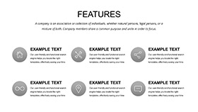
Features Blending Geography and Design
Three masters anchor layouts; three backgrounds showcase flag waves and contour lines.
28 diagrams detail state combos, seven schemes for regional hues. .key/.kth/.jpg in varied ratios ensure fit.
- Integrated Maps: Flags embedded seamlessly.
- Precise Vectors: Zoom without blur.
- Eternal Access: Lifetime post-buy.
Inspired by cartographic standards, it clarifies spatial stories.
28 Slides: From Coast to Coast
Slide 1: Continental overview. Slides 6-10: Regional clusters with flag keys.
Slides 15-20: Economic overlays. Final: National synthesis.
Links to datasets enrich exploration.
Tip: Geo-Sync
Link to GIS for live updates.
Applications in Diverse Fields
Marketers target states via flag-maps, refining campaigns.
Teachers trace history with clusters, engaging classes.
Consultants visualize expansions. Surpasses stocks with fusion.
Why It Outmaps Defaults
Basics lack integration; this excels in detail. Users praise clarity in reports.
$22 forever, with evos. Staple for atlases.
Chart your course. Secure the template today.
Frequently Asked Questions
Version support?
Keynote 2016+.
Map edits?
Full vector control.
Educational fit?
Ideal for geography lessons.
Schemes count?
Seven varied.
Dynamic elements?
Yes, animatable paths.
Policy?
30-day assurance.