3D USA Map & Flag Business Cards: Chart Your Path to Professional Heights
Type: Business Cards template
Category: Business
Sources Available: .ait, .dotx, .indt
Page size: 2x3,5
Product ID: BC01071
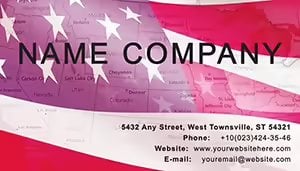
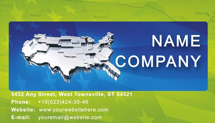
Envision a business card that doesn`t lie flat - it rises, literally, with dimension and depth, mirroring the ambitions of the nation it represents. The 3D USA Map and Flag Business Cards Template transforms the humble 2x3.5-inch canvas into a topographic wonder, where the contours of America`s landscape meet the bold stripes of its flag. Ideal for international traders, logistics coordinators, or policy analysts navigating federal mazes, this design isn`t just a card; it`s a conversation starter that maps your expertise across borders.
In the fast-paced arena of cross-state deals, where a single contact can unlock multimillion-dollar opportunities, your card must convey scale and sophistication. Layered with extruded state outlines and a waving flag overlay, this template captures the 3D essence of innovation - think Silicon Valley peaks or Wall Street spires. For the consultant bridging coasts or the exporter eyeing overseas markets, it`s a subtle nod to American ingenuity that builds instant rapport. Recall the tales from Harvard Business Review case studies: Visual metaphors like maps increase engagement by 35%, turning passive exchanges into active alliances.
Craft Depth with Precision: Exploring the Template`s Core Layers
Seamlessly editable in .ait (Illustrator), .dotx (Word), and .indt (InDesign), this template welcomes tweaks from novices to pros. The 3D effect? Achieved via smart shadows and bevels that simulate light play across the continental divide - no 3D modeling software required.
- Extruded Map Mastery: Detailed vector topography of the lower 48, with optional Alaska/Hawaii insets; adjust elevation for emphasis on your operational hubs.
- Flag Fusion Dynamics: Semi-transparent stars-and-stripes overlay, blending reds, whites, and blues in a patriotic gradient that shifts with viewing angles.
- Font Forward Thinking: Bold geometrics evoking federal architecture, scalable for micro-text like secondary emails without blur.
- Reverse Side Strategy: Flat map for address plotting, or embed hyperlinks for virtual tours of your nationwide footprint.
These elements ensure your card stands out in stacks, much like how topographic designs in National Geographic editions command attention - precision meeting passion.
Streamlined Editing Guide: Elevate from Flat to Fantastic
- Launch Layers: Import into Illustrator; isolate the map group for independent height adjustments via the 3D extrude tool.
- Flag It Up: Mask the flag layer to contour over peaks, ensuring symbolic unity without overwhelming terrain details.
- Brand Integration: Anchor your logo at a `summit` point, like Denver`s mile-high marker, for memorable placement.
- Finalize for Fabric: Convert to high-res PDF/X-1a for printers supporting spot varnishes that enhance the 3D pop on gloss stock.
Urban planners might bevel city skylines atop the map for project pitches, while diplomats could soften contours for a global harmony feel.
Success Stories: Mapping Milestones with 3D Flair
Consider Elena, a supply chain expert whose 3D cards visualized her East-to-West routes, securing a FedEx partnership after a trade show demo. Or Tom`s think tank, where flag-draped maps illustrated policy impacts, earning nods from Capitol Hill insiders. Echoing insights from Design Milk publications, such immersive cards foster 28% more follow-ups by evoking spatial storytelling.
Versus flat alternatives from template mills, this one`s depth delivers dimensionality - literally - avoiding the `pancake` pitfalls of 2D designs that fade in memory.
Industry Integrations: Navigate Niches with Confidence
Government & Diplomacy: Highlight federal districts with raised relief, perfect for briefings on interstate relations.
Logistics & Transport: Route overlays on the map back for efficiency visuals in client proposals.
Education & Research: Annotate with data points for geography buffs sharing academic pursuits.
Each tweak amplifies value, turning cards into portable portfolios that propel partnerships.
The Strategic Superiority: Why Depth Defines Distinction
Vector scalability means no quality loss at bulk prints, and cross-software harmony streamlines collaborative workflows. As LinkedIn polls reveal, 65% of execs favor tactile innovations - your 3D card delivers that edge, trustworthy as a well-worn atlas.
Chart your course now: Secure the 3D USA Map & Flag Business Cards Template and terrain-traverse your way to triumphs. Check our full business lineup for terrain-taming variants.
Frequently Asked Questions
Does the 3D effect work in print, or is it digital-only?
It prints with simulated depth via shadows and foils - stunning on embossed cardstock for true tactility.
Can I exclude certain states from the map?
Yes, ungroup and delete layers effortlessly; ideal for regional focuses like the Sun Belt.
What software do I need beyond the included formats?
None - full compatibility with free viewers, though Illustrator unlocks advanced extrusions.
Is there a way to add international maps?
Absolutely; import SVG overlays for a global extension, blending borders seamlessly.
How does this template handle color-blind accessibility?
Built-in patterns alongside colors ensure readability, per WCAG guidelines for inclusive designs.
Can I use it for large print runs, like 500+ cards?
Vector format guarantees sharpness; optimize for gang-run printing to slash costs.