Harness the exploratory power of Google Earth within PowerPoint using our specialized templates, featuring satellite-style overlays, terrain contours, and pinpoint markers. Aimed at researchers, urban planners, and travel enthusiasts, these designs make geographic storytelling accessible and visually striking.
Visualize climate patterns, migration routes, or market territories with ease, leveraging embedded globes and zoomable layers that mimic the app`s fluidity. No need for advanced GIS skills - our templates handle the heavy lifting so you can focus on your narrative.
Fully editable in Microsoft PowerPoint, they support data imports from spreadsheets for dynamic updates. From classroom geography lessons to corporate expansion plans, ignite curiosity with slides that feel like virtual expeditions.
Unleash your inner explorer: Check out our Google Earth PowerPoint templates and chart courses to compelling content.


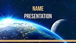


These templates replicate Google Earth`s immersive interface with 3D globes, street-view vignettes, and elevation profiles, transforming flat slides into navigational wonders. Unlike basic map inserts, they offer layered transparency for overlaying stats, fostering deeper analysis without clutter.
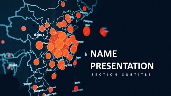
For example, a environmental report might use a template to animate deforestation hotspots, with pins dropping like revelations to highlight intervention zones.
Standard PowerPoint maps lack detail; ours include high-res textures and coordinate systems for precision, rivaling dedicated software.
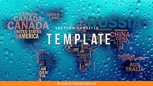
Align your content to scales - use global views for overviews and street-level zooms for specifics. Incorporate color coding from Google Earth`s palette: Blues for water, greens for land, to evoke familiarity.
Edit paths with PowerPoint`s curve tools for custom routes, and add hyperlinks to live Google Earth links for extended exploration during talks.
A NGO`s climate advocacy deck employs the "Planetary Pulse" template: Rising sea levels flood coastal boxes progressively, urging action. In academia, "Heritage Hunt" layers ancient sites over modern cities, flying users through history.
Corporate users adapt "Trade Trails" for logistics, with cargo icons traversing animated shipping lanes. These showcase the templates` flexibility across scales.
Insight: Sync with Excel for auto-updating population bubbles, keeping global demos current.
Projection distortions plague maps; our templates use Mercator variants with scale warnings for accuracy. For large audiences, optimize file sizes by compressing imagery without losing fidelity.
Ensure inclusivity with high-contrast markers for color-blind viewers, broadening accessibility.
Trigger zooms on click for guided tours, or embed quizzes via action buttons on landmarks. Styles range from satellite realism to stylized vectors for artistic flair.
Action Step: Grab a Google Earth PowerPoint template and map out your success story today.
With Google Earth PowerPoint templates, every presentation becomes a gateway to the globe. Expand your horizons - start exploring our selection.
Copyright © 2009-2026 ImagineLayout All rights reserved.