World Country PowerPoint Maps Template for Presentation

Dark World Country PowerPoint maps
Africa World Country PowerPoint maps
Dark Europe World Country PowerPoint maps
Europe World Country PowerPoint maps
Dark South America World Country PowerPoint maps
South America World Country PowerPoint maps
Dark North America World Country PowerPoint maps
North America World Country PowerPoint maps
Dark Australia World Country PowerPoint maps
Australia World Country PowerPoint maps
Dark Asia World Country PowerPoint maps
Asia World Country PowerPoint maps
Dark Africa World Country PowerPoint maps
  • thumbnail slide #0
  • thumbnail slide #1
  • thumbnail slide #2
  • thumbnail slide #3
  • thumbnail slide #4
  • thumbnail slide #5
  • thumbnail slide #6
  • thumbnail slide #7
  • thumbnail slide #8
  • thumbnail slide #9
  • thumbnail slide #10
  • thumbnail slide #11
  • thumbnail slide #12

Type: PowerPoint Maps template

Category: World

Sources Available: .pptx

Product ID: PM00168

Template incl.: 13 editable slides

Purchase this template
$ 26.00

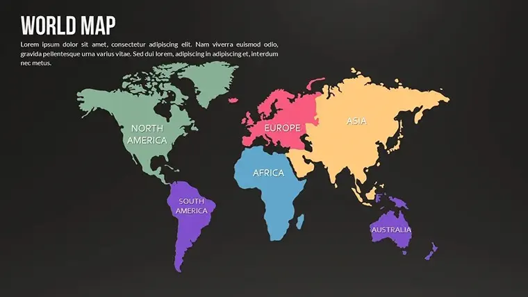
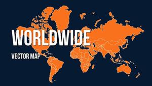
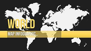
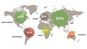
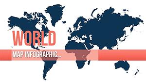
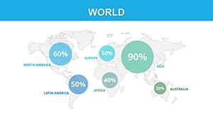
A world-country PowerPoint maps template is a great way to add visual interest and information to your presentation. These templates typically include a map of the world, with each country or region labeled. You can then use the template to add your data or information, such as population statistics, economic data, or cultural information.

Benefits of Using a World Country PowerPoint Maps Template

  • Visual interest: A map is a great way to engage your audience and make your presentation more visually appealing.
  • Information: A map can be used to communicate a variety of information, such as population statistics, economic data, or cultural information.
  • Organization: A template can help you organize your data and information clearly and concisely.

How to Use a World Country PowerPoint Maps Template

To use a world country PowerPoint maps template, simply open the template and replace the placeholder text with your data or information. You can also customize the template's colors, fonts, and other elements to match your presentation's overall theme.

Tips for Using a World Country PowerPoint Maps Template

  • Choose a template that is appropriate for your audience and the topic of your presentation.
  • Make sure the template is well-organized and easy to read.
  • Use clear and concise text and labels.
  • Use colors and fonts that are easy to see and understand.

A world-country PowerPoint maps template is a versatile tool that can be used to add visual interest and information to your presentation. By choosing the right template and customizing it to meet your needs, you can create a presentation that is both informative and engaging.

Worldwide vector maps for PowerPoint presentation
ID: #PM00161
Worldwide vector maps for PowerPoint presentation
World: Global Market PowerPoint Maps
ID: #PM00170
World: Global Market PowerPoint Maps
World Map PowerPoint Template with Continents
ID: #PM00088
World Map PowerPoint Template with Continents
World Countries PowerPoint map
ID: #PM00162
World Countries PowerPoint map
World Infographic PowerPoint Map
ID: #PM00164
World Infographic PowerPoint Map
Widescreen Maps of World for PowerPoint Presentations
ID: #PM00087
Widescreen Maps of World for PowerPoint Presentations
World Infographic PowerPoint maps for Presentation
ID: #PM00163
World Infographic PowerPoint maps for Presentation
Political World PowerPoint Maps Presentation Templates
ID: #PM00086
Political World PowerPoint Maps Presentation Templates