


Type: PowerPoint Maps template
Category: North America
Sources Available: .pptx
Product ID: PM00106
Template incl.: 26 editable slides
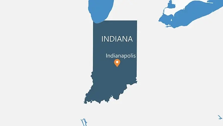
Elevate your presentations with our USA State Indiana PowerPoint Maps Template. Customizable, informative, and perfect for professionals presenting Indiana-related data.
Welcome to our USA State Indiana PowerPoint Maps Template, your gateway to creating powerful and engaging presentations. Whether you're a business professional, educator, researcher, or government official, this template is designed to cater to your specific needs. Unlock the potential of your presentations with our comprehensive collection of Indiana maps that are both visually striking and information-rich.
Why Choose Our Indiana PowerPoint Maps Template:
1. Comprehensive Coverage: Our template includes meticulously detailed maps of Indiana, showcasing its counties, major cities, highways, and geographical features. You can effortlessly incorporate these maps into your presentations to provide context, location-specific data, and regional insights.
2. Versatile Customization: Tailor your presentations to perfection with our template's versatile customization options. Adjust colors, fonts, and layouts to align with your branding or presentation theme, ensuring a consistent and professional look that captivates your audience.
3. Data Visualization Made Easy: Presenting data has never been easier. Our Indiana PowerPoint Maps Template empowers you to plot data on the maps seamlessly. Utilize charts, graphs, and annotations to communicate complex information effectively, fostering deeper understanding among your audience.
4. Ideal for Various Industries: Whether you're in marketing, finance, education, or research, our template serves as a valuable asset. Present market trends, sales figures, educational materials, or demographic data with confidence and impact.
5. User-Friendly Interface: Designed with user experience in mind, our template offers a user-friendly interface, making it accessible to both novice and experienced presenters. Spend less time grappling with technicalities and more time crafting compelling narratives.
Our USA State Indiana PowerPoint Maps Template is a must-have for anyone seeking to create presentations that stand out from the crowd. With its customizable features, extensive coverage, and user-friendly interface, it's the perfect tool for professionals who wish to deliver impactful presentations with ease. Whether you're presenting in boardrooms, classrooms, or conferences, let our template be your secret weapon for success. Elevate your storytelling and captivate your audience with the power of visual data representation. Try our Indiana PowerPoint Maps Template now and witness the difference it makes in your presentations!


Copyright © 2009-2024 ImagineLayout All rights reserved.