


Type: PowerPoint Maps template
Category: Europe
Sources Available: .ppt, .pptx
Product ID: PM00056
Template incl.: 40 editable slides
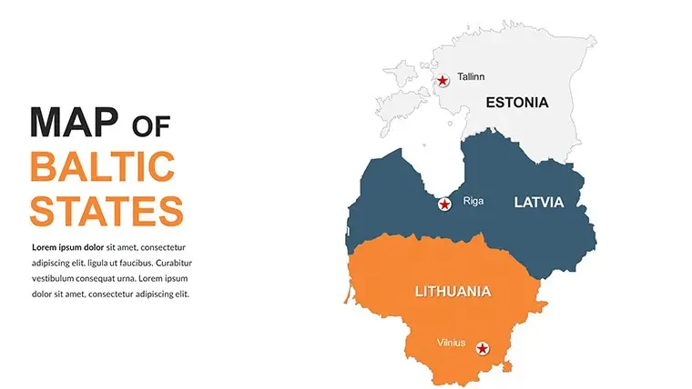
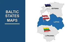
Explore our comprehensive and versatile Editable Baltic States PowerPoint Maps Template. Customizable slides with various options for easy personalization. Ideal for professionals, educators, and presenters seeking impactful visual aids. In this presentation, we offer a powerful tool that allows you to create engaging and informative slides for your professional, educational, or business needs. Our template provides customizable maps of the Baltic States, enabling you to present data, statistics, or information about this region in a visually compelling way.
Why Choose Our Baltic States PowerPoint Maps Template?
Features of the Editable Baltic States PowerPoint Maps Template:
Who Will Benefit from Our Template? Our Editable Baltic States PowerPoint Maps Template caters to a diverse audience, including:
Our Editable Baltic States PowerPoint Maps Template empowers you to create captivating and informative presentations with ease. With a focus on customization and user-friendliness, this versatile template is perfect for professionals, educators, and presenters seeking impactful visual aids. Embrace the power of visual storytelling and grab your audience's attention today!


Copyright © 2009-2024 ImagineLayout All rights reserved.