


Type: Keynote Maps template
Category: North America
Sources Available: .key
Product ID: KM00109
Template incl.: 26 editable slides
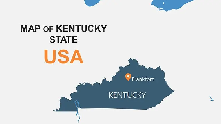
The state of Kentucky is located in the southeastern region of the United States and is known for its horse racing, bourbon, and southern hospitality. With a total of 120 counties, Kentucky is the 26th most populous state in the country.
One effective way to understand the geography and demographics of Kentucky is through a keynote map of its counties. A Keynote map is a type of map that uses colors or symbols to represent different data points, providing a visual representation of information that is easy to read and understand.
When creating a Keynote map of Kentucky counties, there are a few key factors to consider. These include population, land area, major cities and towns, and natural features such as rivers and lakes. By highlighting these factors on the map, viewers can quickly gain insight into the makeup of each county and its significance in the overall state.
For example, a Keynote map of Kentucky counties that shows population density can help viewers understand which areas are the most heavily populated. This information can be helpful for businesses or organizations that are looking to target specific populations, such as those with high levels of education or income.
Another factor to consider when creating a Keynote map of Kentucky counties is the land area of each county. This can be particularly useful for individuals or organizations that are interested in land use, such as conservationists or developers. By mapping out the areas with the most open land or natural resources, these groups can gain insight into where they should focus their efforts.
Major cities and towns are also important factors to consider when creating a Keynote map of Kentucky counties. These can include cities such as Louisville, Lexington, and Bowling Green, which are significant economic and cultural centers within the state. By highlighting these areas on the map, viewers can gain a better understanding of where the major population centers are located and what industries are driving the local economy.
Finally, natural features such as rivers, lakes, and mountains can also be important to include in a Keynote map of Kentucky counties. These features can provide important context for understanding the geography and ecology of the region. For example, a map that shows the location of major rivers and lakes can be useful for those interested in fishing or boating, while a map that highlights the location of major mountains can be useful for hikers and outdoor enthusiasts.
Overall, a Keynote map of Kentucky counties can be a valuable tool for understanding the geography, demographics, and natural features of the state. By highlighting key data points such as population, land area, major cities and towns, and natural features, these maps can provide viewers with a quick and easy way to gain insight into the makeup of each county and its significance in the overall state.

Copyright © 2009-2024 ImagineLayout All rights reserved.